
NAUTICAL CHARTS
par Andrea Paparella
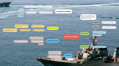
1. GREAT CIRCLE TRACK
1.1. imaginary line drawn on the surface which joins 2 points with a minimum distance
1.2. cuts through the meridians at varying angles
1.2.1. so you often have to calculate the angle of the course
1.3. long distances
2. RHUMB LINE
2.1. curved line which joins 2 points on the Earth's surface and lies a plane which doesn't intersect the centre
2.2. cuts through the meridians at a constant angle
2.3. short distances
3. MAPS & CHARTS
3.1. are drawn to different scales which are indicated in the chart's margin
3.1.1. the scale refers to the ratio between real dimensions and the size of the area as appears on the chart
3.2. geographical and nautical chart
3.2.1. are drawn using PROJECTION
3.2.1.1. this involves projecting an area onto a projecting plane from a viewpoint or using a particular projection method
4. PASSAGE PLANNING
4.1. procedure to develop a complete description of a vessel's voyage from start to finish
4.2. regulated by IMO Resolution A.893(21)
4.2.1. Sets 4 steps to becarried out
4.2.1.1. APPRAISAL
4.2.1.2. PLANNING
4.2.1.3. EXECUTION
4.2.1.4. MONITORING