

1. TOPOGRAPHY
1.1. Objectives
1.1.1. To identify
1.2. Analysis / Parameters
1.2.1. soil type
1.2.2. natural elements
1.2.2.1. mountains / hill
1.2.2.2. lake / pond
1.2.2.3. sea / beach
1.2.3. vantage point
1.2.3.1. highest point
1.2.3.2. visual axis
1.3. Expected outcome
1.3.1. site cross-section
1.3.1.1. Proposal
1.3.1.1.1. suitability for proposed building typology/function
1.3.1.1.2. improve urban form / imageability
2. ORIENTATION
2.1. Objectives
2.1.1. To determine sunpath/shadow casting
2.2. Analysis / Parameters
2.2.1. sunpath / shadow
2.2.2. building orientation
2.3. Expected outcome
2.3.1. sunpath/shadow casting diagram
2.3.1.1. Proposal
2.3.1.1.1. incorporate passive design solution
2.3.1.1.2. increase energy efficiency & comfort
2.3.1.1.3. increase financial value of the building
3. VISUAL ASPECT
3.1. Objectives
3.1.1. To identify and assesses existing urban form
3.2. Analysis / Parameters
3.2.1. Legibility & Imageability study (K. Lynch)
3.2.1.1. Edges
3.2.1.1.1. - hedges / landscape barrier
3.2.1.2. District
3.2.1.2.1. - neighbourhood
3.2.1.2.2. - commercial district/centre
3.2.1.2.3. - waterfront
3.2.1.3. Paths
3.2.1.3.1. - all roads & linkages
3.2.1.3.2. - connectivity
3.2.1.4. Landmarks
3.2.1.4.1. - place identification
3.2.1.5. Nodes
3.2.1.5.1. - gathering places & local hotspots
3.2.1.5.2. - local hotspot
3.3. Expected outcome
3.3.1. Cognitive map
3.3.1.1. Proposal
3.3.1.1.1. improve urban form / imageability / legibility
4. BUILT ENVIRONMENT
4.1. Objectives
4.1.1. To identify and assess existing quality of built environment
4.2. Analysis / Parameters
4.2.1. Architectural style
4.2.2. Grid / layout (roads)
4.2.3. Open space / public space
4.2.4. Building typology
4.3. Expected outcome
4.3.1. location map + photo elaboration
4.3.1.1. Proposal
4.3.1.1.1. improve urban form / imageability
4.3.1.1.2. efficient planning
5. ACCESSIBILITY
5.1. Objectives
5.1.1. To identify existing and future entryways/entry points & district/regional access point into the site
5.2. Analysis / Parameters
5.2.1. Location & routes (to be marked in map)
5.2.1.1. Waterways / ports
5.2.1.2. Highway & highway exits
5.2.1.3. Main roads
5.2.1.4. Nearest airport
5.2.1.5. Bus terminal
5.2.1.6. Train stations
5.3. Expected outcome
5.3.1. location mapping
5.3.1.1. Proposal
5.3.1.1.1. improve accessibility
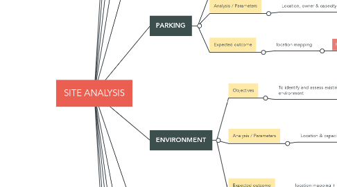
6. PARKING
6.1. Objectives
6.1.1. To identify existing parking location, system and capacity of the area they serve
6.2. Analysis / Parameters
6.2.1. Location, owner & capacity (to be marked in map)
6.3. Expected outcome
6.3.1. location mapping
6.3.1.1. Proposal
6.3.1.1.1. efficient parking management
6.3.1.1.2. parking system
7. TRANSPORTATION
7.1. Objectives
7.1.1. To identify means of transportation intercity and intracity
7.2. Analysis / Parameters
7.2.1. Location (to be marked in map)
7.2.1.1. Main transit hub/terminals (train, bus, taxi, ferry port)
7.2.1.2. Transit stop (bus stand, taxi stand)
7.3. Expected outcome
7.3.1. location mapping
7.3.1.1. Proposal
7.3.1.1.1. improve transportation system
7.3.1.1.2. ideal location for transportation hub
8. ENVIRONMENT
8.1. Objectives
8.1.1. To identify and assess existing quality of environment
8.2. Analysis / Parameters
8.2.1. Location & capacity (to be marked in map)
8.2.1.1. Weather & climate
8.2.1.2. Ecosystem & biodiversity
8.2.1.3. Pollution / waste
8.2.1.4. Recreational / cultural value
8.3. Expected outcome
8.3.1. location mapping + photo elaboration
8.3.1.1. Proposal
8.3.1.1.1. Environmentally friendly design
8.3.1.1.2. Passive design
9. EXISTING PLANTING & LANDSCAPE ELEMENTS
9.1. Objectives
9.1.1. To identify existing open spaces, users & activities
9.1.2. To identify native species within the site
9.2. Analysis / Parameters
9.2.1. Function (based on facilities/amenities)
9.2.2. Location (to be marked in map)
9.3. Expected outcome
9.3.1. Landscape master plan
9.3.1.1. Proposal
9.3.1.1.1. Increase outdoor activities
9.3.1.1.2. determining image / character
9.3.1.1.3. compliment / shared functions
9.3.1.1.4. create sustainable planting design
10. PEDESTRIAN LINKAGES
10.1. Objectives
10.1.1. To identify existing facilities and its connectivity
10.2. Analysis / Parameters
10.2.1. Connection (to be marked in map)
10.2.1.1. Footpath
10.2.1.2. Bicycle path
10.2.1.3. Transition node (pocket park, shelter)
10.3. Expected outcome
10.3.1. location mapping
10.3.1.1. Proposal
10.3.1.1.1. improve pedestrian system & inclusivity towards disabled community
10.3.1.1.2. Increase pedestrian activities
10.3.1.1.3. reduce carbon footprint
11. UTILITY RETICULATION SYSTEM
11.1. Objectives
11.1.1. To identify existing utilities and its systems
11.2. Analysis / Parameters
11.2.1. Location (to be marked in map)
11.2.1.1. Power / Electrical distribution
11.2.1.1.1. TNB sub-station / national grid
11.2.1.1.2. Solar farms / wind farms / geothermal / hydroelectric dams
11.2.1.2. Water distribution system
11.2.1.2.1. reservoir
11.2.1.2.2. water treatment plant
11.2.1.2.3. water tower / district distribution system
11.2.1.2.4. waste water facilities / sewage treatment plant / communal septic tank / oxidation pond
11.2.1.3. Waste management
11.2.1.3.1. incinerator
11.2.1.3.2. landfill
11.2.1.3.3. recycling centre
11.3. Expected outcome
11.3.1. location mapping
11.3.1.1. Proposal
11.3.1.1.1. municipal/district/regional data centre
11.3.1.1.2. self-sustaining supply system
11.3.1.1.3. efficient waste management
11.3.1.1.4. renewable energy
12. SURROUNDING DEVELOPMENT
12.1. Objectives
12.1.1. To identify location, character & functions of other development around the site (2-5km from site)
12.2. Analysis / Parameters
12.2.1. Location (2-5km radius from site)
12.2.2. Character of the development
12.2.3. Function (based on facilities/amenities)
12.3. Expected outcome
12.3.1. imageability / character
12.3.1.1. Proposal
12.3.1.1.1. compliment / shared functions
12.3.1.1.2. determining image / character
13. LAND USAGE
13.1. Objective
13.1.1. To identify existing land use and density of the site/study area
13.2. Analysis / Parameters
13.2.1. Diversity
13.2.1.1. Commercial
13.2.1.2. Residential
13.2.1.3. Open space / park / recreational
13.2.1.4. Industrial
13.2.1.5. Agriculture
13.2.1.6. Institutional
13.2.1.7. Utilities
13.2.1.8. Undeveloped land
13.2.2. Density
13.2.2.1. Population
13.2.2.2. Activities
13.3. Expected outcome
13.3.1. land use map
13.3.2. population density map/diagram