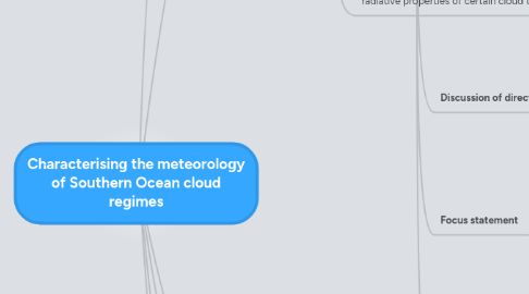
1. What do we know about the ISCCP cloud regimes?
1.1. We know something about the arrangement of the clouds about mid-latitudes cyclones. However, a lot of the radiative bias is at higher latitudes than the strongest part of the storm track. So maybe they're not only related to cyclones, although that might be part of it.
1.2. Is the model physics failing to create certain meteorological conditions that are related to the clouds?
1.3. Is something missing in the cloud structure itself?
1.4. Is something missing in the cloud microphysics (droplet size or phase), that relates to the radiative properties of certain cloud types?
1.4.1. ISCCP has trouble observing mid-level clouds (Haynes et al, 2011). Very likely they're actually layered cloud, with thinner layers above a thick low cloud deck
2. ISCCP cloud regimes
2.1. Cloud regime histograms and structure (as in Haynes et al 2011)
2.2. Regime distribution and relative frequency of occurrence (DJF)
2.3. Structure / organisation
3. Introduction
3.1. Paragraph 1 (global diagnoses of radiative biases, related to clouds)
3.1.1. Uncertainties in estimates of climate sensitivity is in large part a product of uncertain cloud feedbacks.
3.1.2. Attention is currently focused on evaluating and improving cloud models based on zonal shortwave and longwave radiative biases. (Probst? 2012 -- that paper I found today)
3.1.3. One of the greatest zonal biases is a surplus of absorbed shortwave radiation over the high-latitude Southern Ocean (Trenberth and Fasullo 2010).
3.2. Paragraph 2 (Broad efforts at evaluation and improvement)
3.2.1. CFMIP and other model inter-comparison projects
3.3. Paragraph 3 (Focus on Southern Ocean as an area of positive shortwave radiation bias)
3.3.1. Downwelling shortwave bias is spatially distributed in the high latitude Southern Ocean, and seasonally focussed on DJF (Trenberth and Fasullo 2010) [ check against Haynes et al 2011 for interpretation ]
3.3.2. Association with the poleward shift of the storm track (Yin 2005)
3.3.3. Analysis of cloud representation around a composite cyclone. (Williams et al 2012, Bodas-Salcedo 2012, Govekar et al 2012)
3.4. Paragraph 4 (Cloud regime techniques)
3.4.1. Efforts to evaluate cloud representation in climate models often focus on the net radiative bias owing to shortwave and longwave fluxes.
3.4.1.1. Williams et al (2012) studied the radiative biases around a composite cyclone, and found positive downwelling shortwave radiation biases in both the cold-air part of the cyclone and in areas ahead of transient fronts.
3.4.2. Another technique is to separate instances of cloud into self-similar events, called regimes.
3.4.2.1. Jakob and Tselioudis (2003) implemented a k-means clustering algorithm on ISCCP histograms of observed cloud-top pressure (CTP) and optical thickness (tau) within a 280 km grid box.
3.5. Broad context
3.5.1. Importance of clouds to radiation budget
3.5.2. Evaluating and improving the representation of cloud in climate models
3.5.3. Major area of interest: present-day downwelling shortwave radiation bias over Southern Ocean (Trenberth and Fasullo 2010)
3.6. Literature review: analysis techniques for evaluation of Southern Ocean cloud biases
3.6.1. Observations
3.6.1.1. Cloud amount (ISCCP )
3.6.1.1.1. Haynes et al (2011) show distribution of some dynamical variables and microphysical observations
3.6.1.1.2. Gordon and Norris (2012) generate regimes with a coarser ISCCP histogram, for the global extra-tropical oceans
3.6.1.2. Radiation budget (CERES, ERBE)
3.6.2. Model evaluation
3.6.2.1. Climatology
3.6.2.1.1. Downwelling shortwave bias is spatially distributed in the higher latitudes, and seasonally focussed on DJF (Trenberth and Fasullo 2010)
3.6.2.2. Dynamics (composite cyclones)
3.6.2.2.1. Shortwave bias is strongest in the cold-air part of the cyclone and leading transient fronts (Williams et al 2012)
3.6.2.3. Cloud regimes
3.6.2.3.1. ISCCP CTP-tau histograms (Jakob and Tselioudis 2003)
3.6.2.3.2. Williams and Webb (2009) use modified k-means clustering (including TCC) for use in model evaluation.
3.7. Discussion of direction
3.7.1. It's well documented that the models misrepresent the radiative properties of certain cloud types in the Southern Ocean.
3.7.1.1. This appears to be strongly related to what ISCCP sees as "mid-top" cloud
3.7.2. Full characterisation of observed state of the atmosphere associated with the cloud regimes will facilitate evaluation
3.8. Focus statement
3.8.1. This study aims to more fully characterise the meteorology of the ISCCP cloud regimes using ISCCP observations, re-analysis data, and radiosonde observations.
3.8.2. Will be followed by an assessment of the cloud structure and microphysics using active satellite observations (Lidar and Radar)
3.9. Structure of this analysis
3.9.1. Data sets: ISCCP D1, ERA-Interim and Macquarie Island radiosondes
3.9.2. ISCCP cloud regimes: CTP-tau histograms and vertical structure, spatal and temporal distribution, and frequency of occurrence.
3.9.3. Regime meteorology: profiles of dynamical and thermodynamical properties, comparison between re-analysis and radiosonde observations.
3.9.4. Discussion and conclusion
4. Data sets
4.1. ISCCP D1
4.2. ERA-Interim reanalysis
4.3. Macquarie Island radiosondes
5. Regime meteorology
5.1. Mean and 1-sigma quantile distribution of dynamical and thermodynamical variables; means and monthly anomalies.
5.1.1. Omega
5.1.1.1. Stable atmospheres: S1 -- S4, S8
5.1.1.2. Unstable: S5, S6 & S7 (frontal)
5.1.2. Theta
5.1.2.1. S4 is anomalously cold
5.1.2.2. S7 (frontal) is warm
5.1.3. RH
5.1.3.1. S4 & S5 show mid-level moisture maxima
5.1.3.2. S6 and S7 reflect cirrus and deep frontal cloud
5.1.4. Temperature advection
5.2. Comparison of Southern Ocean anomaly profiles against Macquarie Island radiosonde observations
5.2.1. Found good agreement between observed and re-analysis profiles for available variables (theta, RH... what else?)
5.3. Check: comparison of SO anomaly profiles against Macquarie Island-only ERA-Interim profiles, as well as ERA-Interim profiles from a range of other points.
5.3.1. Expect relative frequency of occurrence to change, but not the main features of the anomaly profiles
6. Discussion/Conclusion
6.1. That these cloud regimes are a robust indicator of underlying meteorological conditions (agreement with observations)
6.2. That the two mid-topped regimes are meteorologically distinct, as suggested by distribution of single mid-top cloud regime around a composite cyclone (Williams et al, 2012).
6.2.1. S4 is related to the cold-air section of extratropical cyclones
6.2.2. S5 resembles a weak frontal event (leading side of a "transient ridge"; Williams et al, 2012)
