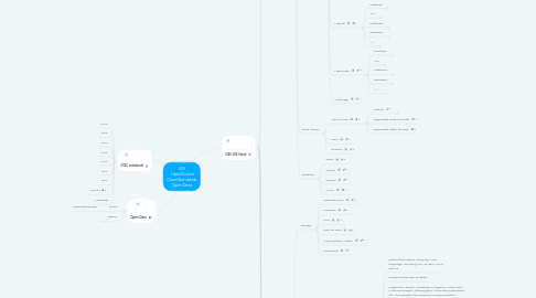
1. OGC standards
1.1. WMS
1.2. WFS
1.3. WCS
1.4. WPS
1.5. CWS
1.6. SFS
1.7. GML
1.8. WCPS
1.9. Metadata
2. Open Data
2.1. Vector
2.1.1. OpenStreetMaps
2.2. Raster
2.2.1. ASTER
2.2.2. SRTM
3. OSS GIS Stack
3.1. History
3.1.1. MileStones
3.1.1.1. Solomon Stuart - Sol Katz
3.1.1.2. 1978 - MOSS
3.1.1.3. 1983 - Proj4
3.1.1.4. 1995 - UMN Mapserver
3.1.1.5. 1998 - GDAL/OGR
3.1.1.6. 1999 - GRASS GIS
3.1.1.7. 2000 - JTS Topology suite
3.1.1.8. 2001 - PostGIS
3.1.1.9. 2002 - Quantum GIS
3.1.1.10. 2002 - GEOS
3.1.1.11. 2005 - Google/Yahoo/Bing maps/mushup
3.1.1.12. 2006 - OSGEO
3.1.1.13. CMS plugins
3.1.1.13.1. Drupal
3.1.1.13.2. Joomla
3.1.1.13.3. WikiMedia
3.1.2. Organizations
3.1.2.1. Open GRASS Foundation
3.1.2.2. OGC
3.1.2.3. OSGEO
3.2. C/C++ Stack
3.2.1. Librarys
3.2.1.1. GEOS
3.2.1.1.1. Features
3.2.1.1.2. API
3.2.1.1.3. Platforms
3.2.1.2. Proj4
3.2.1.2.1. Features
3.2.1.2.2. API
3.2.1.2.3. Platforms
3.2.1.3. Shapely
3.2.1.4. PySAL
3.2.2. WEB Mapping
3.2.2.1. MapServer
3.2.2.1.1. Features
3.2.2.1.2. API
3.2.2.1.3. Platforms
3.2.2.1.4. Renderer
3.2.2.1.5. + / -
3.2.2.2. Mapnik
3.2.2.2.1. Features
3.2.2.2.2. API
3.2.2.2.3. Platforms
3.2.2.2.4. Renderer
3.2.2.2.5. + / -
3.2.2.3. MapGuide
3.2.2.3.1. Features
3.2.2.3.2. API
3.2.2.3.3. Platforms
3.2.2.3.4. Renderer
3.2.2.3.5. + / -
3.2.2.4. AcidMaps
3.2.3. Data drivers
3.2.3.1. GDAL/OGR
3.2.3.1.1. Utilities
3.2.3.1.2. Supported vector formats
3.2.3.1.3. Supported raster formats
3.2.3.2. FDO
3.2.3.3. PostGIS
3.2.4. Desktop
3.2.4.1. QGIS
3.2.4.2. OSSIM
3.2.4.3. GRASS
3.2.4.4. SAGA
3.3. .NET Stack
3.3.1. Librarys
3.3.1.1. GeoTools.NET
3.3.1.2. Proj.NET
3.3.1.3. NTS
3.3.1.4. GeoAPI.NET
3.3.1.5. MapWindow ActiveX
3.3.1.6. DotSpatial
3.3.2. Mapping
3.3.2.1. SharpMap
3.3.2.1.1. Features
3.3.2.1.2. Suported formats
3.3.2.2. BruTile
3.3.3. Data drivers
3.3.3.1. MsSQLSpatial
3.3.4. Desktop
3.3.4.1. MapWindow
3.4. Java Stack
3.4.1. Library
3.4.1.1. JTS
3.4.1.2. WKB4J
3.4.1.3. Proj4J
3.4.1.4. GeoTools
3.4.1.5. Imageio-ext
3.4.2. Mapping
3.4.2.1. GeoServer
3.4.2.2. Degree
3.4.2.3. Acidmaps
3.4.3. Data drivers
3.4.3.1. JASPA
3.4.4. Desktop
3.4.4.1. terrainbender
3.4.4.2. OpenJump
3.4.4.3. Udig
3.4.4.4. GvSig
3.4.4.5. OrbisGIS
3.5. App frameworks
3.5.1. OpenLayers
3.5.2. GeoDjango
3.5.3. pMapper
3.5.4. GeoEXT
3.5.5. OpenScales
3.5.6. MapFish
3.5.7. Proj4js
3.5.8. GeoMayas
3.5.9. deegree
3.5.10. Polymaps
3.6. Data storage
3.6.1. PostgreSQL/PostGIS
3.6.2. SQLite Spatial
3.6.3. H2/JASPA
3.6.4. MySQL Spatial
3.7. OGC Implemetation (serverComponents)
3.7.1. Standard implementation
3.7.1.1. TileCache
3.7.1.2. MapProxy
3.7.1.3. MapProxy
3.7.1.4. ZOO WPS
3.7.1.5. TileStache
3.7.1.6. GeoWebCache
3.7.1.7. Rasdaman
3.7.1.8. TinyOWS
3.7.1.9. ncWMS
3.7.1.10. LAS
3.7.1.11. FeatureServer
3.7.1.12. PyWPS
3.7.2. Security
3.7.2.1. GeoShield
3.7.2.2. secureOWS
3.7.2.3. 52n WSS
3.7.2.4. GeoPrisma
3.8. SDI Mashups
3.8.1. GeoNode
3.8.2. OpenGEO Suite
3.8.3. GeoNetwork
3.9. Other projects
3.9.1. Distributions
3.9.1.1. Ubuntu VM GIS
3.9.1.1.1. GISVM base
3.9.1.1.2. GISVM desktop
3.9.1.1.3. GISVM server
3.9.1.2. Arramagong
3.9.1.3. GIShost
3.9.2. Portable GIS
3.9.3. Mashups
3.9.3.1. FWTools
3.9.3.2. OSGeo4W
3.9.3.3. Ms4Win
