Unit 1 - Water On Land
作者:Huseyin Turacli

1. Floodplains, flat land around rivers meanders, bend or curve in a river ox-bow lakes, when thalweg erodes outer sides of meander till the two ends meat and cause left over to be an ox- bow lake (swans neck meander before) deltas, when deposits faster than it ois removed and estuarteries wide mouth.
2. Effects upon river discharge as shown on hydrographs - lag time = peak discharge- peak rainfall. Rising limb and falling limb. Approach segment Flashy- respond quickly to rain. Delayed is opposite.
3. Physical and human causes of flooding- A steep-sided channel, A lack of vegetation or woodland, A drainage basin in an urban area, A drainage basin, consisting of mainly impermeable rock
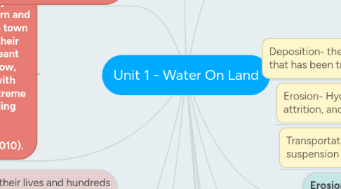
4. Case Study- Rich country UK Tewkesbury (2007)Severn and the Avon, meeting in the town which both overflowed their banks. Little sunshine meant evaporation rates were low, which when combined with intense rainfall led to extreme flooding. Reasons= Building on floodplains· No flood defences in Tewkesbury (Environment Agency, 2010).
5. Case Study- Poor country Bangladesh (2005) 25 per cent of Bangladesh is less than 1 m above sea level The low-lying land means it is easily flooded. Half the country is less than 6m above sea level. The snowmelt in the Himalayas adds water into the main rivers. Building on the floodplains and cutting down trees both increase the effects of flooding.
6. Hard engineering- straightening meanders, building a sea wall, building groynes, rock armour or bounder barrier. Most expensive, bad looking and hard to maintain but it is effective. Soft engineering Managed retreat- areas allowed to flood such as salt marshlands- beach managment- replace cliff material- attract tourists but needs replacement.
7. The flat floodplains of the delta are very fertile. Rice is grown. The area can also be used for shrimp farming.
8. The low-lying islands are very vulnerable and flood easily. It is difficult to protect them. There are poor communications. Many locals do not own their own telephone or television so it is difficult to give successful flood warnings.
9. The Flood Action Plan is funded by the world bank. It funds projects to monitor flood levels and construct flood banks/artificial levees. More sustainable ways of reducing the flooding include building coastal flood shelters on stilts and early-warning systems.
10. 13 people lost their lives and hundreds had to be evacuated, 50,000 homes affected, 850 families had to stay in caravans, 50,000 properties without power for 48 hours, Total cost to UK economy estimated to be £3.2 billion, 9,000 businesses affected, More than 180,000 insurance claims
11. RAF helicopters were used in the rescue efforts and the army supplied food to cut off towns. £800 million was spent on flood defences in the long run. 34 new flod defences- protects 30,000 houses
12. Erosion Transportation deposition
13. At source quick descent gradient and near the middle or lower course the gradient gets lowever less steep
14. Cross Profile- Upper course (verticle erosion with hydraulic action, abrasion & atrittion processes). Middle course (deeper and wider- verticle erosion decreases in inportance- more lateral erosion). Lower course (widest and deepest and may be tidal- depostition more important than erosion- fine material- large amounds of load and size very small)
15. V-Shaped Valleys, interlocking spurs, waterfalls and gorges- resistant rock on top and soft underneath. Water erodes bottom not top. there is undercitting and ceates pludgepool. Falls when too heavy and gorges retreat.
16. Water Supply case study- Lake Vyrnwy, North Wales- Built in 1888, provides water for 900,000 people and 68 miles long pipe. 210 million liitres a day. However 10 farmhouses and chapels where destroyed- Welsh water taken by british. Horse riding and half marathon brings tourists. 90 species of bird breed on resevoir. Now a nature reserve. 4.5 km2 so many habitats destroyed. Cost 22 million pounds. Loss of farmland and lots of money to sustain. 200,000 + touists a year means income.
17. Erosion- Hydraulic Action, abrasion attrition, and solution.
18. Transportation- traction, saltation, suspension and solution
19. Deposition- the dumping of sediment that has been transported by the river
20. Discharge- volume of water passing given point any moment in time. Drainage basin- area river gets water boundary marked by watershed. porous- water in, impermeable- no water in, pervious water in verticle joints and horizontal bending planes. Urbanisation. SOIL EROSION & LEVEES


