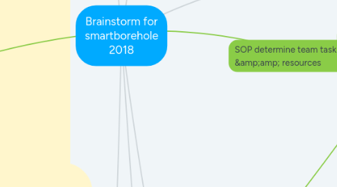
1. Local Council
1.1. Payment Solution?
1.2. Submission
1.2.1. DBKK
1.2.1.1. Version 1 (2015) - ArcMap 9.2
1.2.1.1.1. CD
1.2.1.2. Version 2 proposal (2017 ) - ArcMap 10
1.2.1.2.1. CD
1.2.1.2.2. arcgisonline upload
1.2.2. other councils (upcoming)
1.2.2.1. MTP
2. Proposed Manpower & Resource
2.1. Team's job scope
2.1.1. Librarian
2.1.2. GIS Developer
2.1.3. GIS co-ordinator
2.1.4. GeoTech Specialist
2.2. E-Learning
2.2.1. ESRI
2.2.1.1. ArcMap 10
2.2.1.1.1. introduction to ArcGIS Desktop
2.2.1.1.2. Editing in ArcGIS Desktop
2.2.1.2. Arcgisonline
2.2.1.2.1. 1-getting started with arcgisonline
2.2.1.2.2. 2- mapping basics
2.2.1.2.3. 3- administration basic
2.2.1.2.4. 4- group basics
2.2.1.2.5. 5- set up an ArcGIS organisation
2.2.2. brainstorm & collaboration
2.2.2.1. mindmeister brainstorm for all except librarian
2.2.2.1.1. help centre
2.2.2.2. meistertask online collaboration for all
2.2.2.2.1. help centre
2.3. Team's Task & Resource
2.3.1. Librarian
2.3.1.1. Desktop, DVD Burner,Xerox ,library shelf labels
2.3.1.2. excel, meistertask only,whatsapp,image&pdf converter,google drive, gmail
2.3.2. GeoTech Specialist
2.3.2.1. IEM's Asus Laptop
2.3.2.2. excel, meisterlab suites,,whatsapp,,google drive, gmail, Arcmap10, Arcgisonline
2.3.3. GIS Developer/Speacilist
2.3.3.1. Tablets
2.3.3.2. excel,word,chm, meisterlab suites,,whatsapp,google drive, gmail, Arcgisonline,lucidchart
2.3.4. GIS co-ordinator
2.3.4.1. Mobilephone & library shelf
2.3.4.2. excel, meisterlab suites,,whatsapp,google drive, gmail, Arcgisonline
3. GIS borehole asset life cycle management
3.1. UPGRADE by new platform
3.1.1. GIS platform with shapefile
3.1.1.1. QGIS platform??
3.1.1.1.1. alternate open source desktop GIS
3.1.1.1.2. Get started with QGIS
3.1.1.2. ESRI platform
3.1.1.2.1. ArcMap 9.2 (desktop)
3.1.1.2.2. ArcMap 10 (desktop)
3.1.2. 3D Geological modelling & web tool?
3.1.2.1. Subsurface Viewer platform
3.1.2.1.1. Subviewer MX
3.2. MAINTENANCE by edit or patch up
3.3. UPDATE cycle by edit
3.3.1. smartborehole 2017
3.3.1.1. Arcgis Online
3.3.1.1.1. Pro
3.3.1.1.2. Con
3.3.2. ESRI
3.3.2.1. ArcMap 10 (desktop)
3.3.2.1.1. Map layers
3.3.2.1.2. Borepoints
3.3.3. QGIS?
3.4. ENHANCEMENT for present platform by features & 3rd party plugin
3.4.1. Bentley geotech suites?
3.4.1.1. datgel
3.4.1.2. Gint & AGS file
3.4.2. Subsequent Fence diagram processing by user using Insight - Subsurface viewer?
3.4.2.1. XL & MX
3.4.3. ESRI
3.4.3.1. ArcMap 10 (desktop)
3.4.3.1.1. features
4. SOP templates of workflow, procedure & data process for project members
4.1. Proposed SOP templates
4.1.1. SOP 2017 for Upgrade, enhance,update & maintenance cycle.
4.1.1.1. snapshot of data flow for various task
4.1.1.1.1. task detail and scenario
4.1.1.2. web account management
4.1.1.2.1. GIS Co-ordinator
4.1.1.2.2. GeoTech Specialist
4.1.1.2.3. Librarian
4.1.1.2.4. GIS Co-ordinator
4.1.1.3. Topics for SOP 2017 by Meistertask via Quick start w.r.t project members
4.1.2. SOP 2018-20 for Update cycle only. (Upcoming)
4.2. SOP 2015 (first edition)
4.2.1. workflow of IEM library shelving, scanning and hyperlink
4.2.2. Acrmap 9.2 MXD production process
4.2.3. smart borehole Procedure and storage
4.2.4. Entity diagram
4.2.4.1. Folder directory structure
5. Web & Mobile App
6. Library shelving, record & database relationship
6.1. library shelving
6.1.1. photocopy summary of full report (or print from CD media report given by SI contractor, if available)
6.1.1.1. scan (or extract from CD) to e Print Summary of pdf & jpegs or other agreed format
6.1.2. labeled bags of hPrintSummary on shelf
6.1.3. codify , sort & file full report on shelf
6.2. proposed records of ePS (c:\smbh\eps)
6.2.1. dbkk
6.2.1.1. subfolders of project code
6.2.1.1.1. borelog pdf or other agreed format
6.2.1.1.2. location map jpeg
6.2.1.1.3. cross section jpeg or other agreed format with fence diagram (if availabe)
6.2.2. other councils
6.3. database
6.3.1. excel spreadsheet
6.3.1.1. ePrintSummary
6.3.1.2. arcgis table
6.3.2. Data and folder management
6.3.2.1. ArcMap 9.2
6.3.2.2. ArcMap 10
6.3.3. Esri
6.3.3.1. propose ArcMap 10
6.3.3.1.1. Arcgis 10 (mxd file)
6.3.3.1.2. zipped borepoints layer
6.3.3.2. ArcMap 9.2
6.3.3.2.1. ums legacy
7. geospatial solution
7.1. Server-client technology Infrastructure
7.1.1. GIS Server for borepoint and borelog database storage
7.1.1.1. smartborehole 2015
7.1.1.1.1. leverage on DBKK's existing database system
7.1.1.2. smartborehole 2017
7.1.1.2.1. leverage on state-level institution to host state-wided database system?
7.1.1.2.2. Paid GIS server license for state-wide coverage?
7.1.2. GIS thin client for borepoint location presentation
7.1.2.1. smartborehole 2015
7.1.2.1.1. DBKK arcgis 10.2 desktop only
7.2. borehole gis literature
7.2.1. geospatial application
7.2.1.1. 2D mapping and database
7.2.1.1.1. For ArcMap 10
7.2.1.1.2. For ArcMap 9.2
7.2.1.2. 3D Geological modelling
7.2.1.2.1. Subsurface viewer
7.2.2. database centric
7.2.2.1. british geology society
7.2.2.1.1. logical data model (for future upgrade to ver 3)

