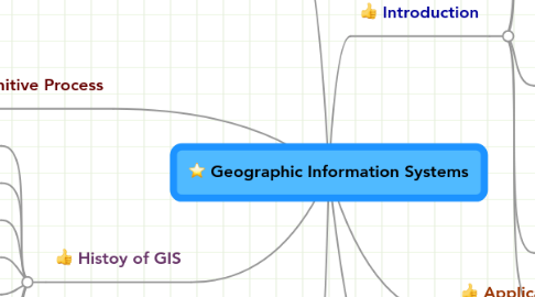
Geographic Information Systems
af GeoSpatial Computing EM-TECH S15


1. Relationship of GIS with the Human Cognitive Process
1.1. Definition of Cognitive
1.2. Cognitive Brain
1.2.1. Environmental Psychological Perspective
1.2.2. GIS as tools for decision making
1.3. Forms of Spatial Representation
1.3.1. Image vs. Propositions
1.3.2. Hierarchical vs. Non Hierchical Structures
1.3.3. Frames of Reference
2. Histoy of GIS
2.1. Early Years: Cro-Magnon Hunters
2.2. 1854: John Snow's plotting of the cholera outbreak
2.3. 1962: First True GIS
2.4. 1964: Laboratory for Computer Graphics and Spatial Analysis
2.5. 1970: Seminal Software Code Systems "SYMAP" "GRID" "ODYSSEY"
2.6. 1982: Public Domain GIS
2.7. Early 20th Century: Photo Lithography
2.8. End of 20th Century: GIS Over the Internet
3. Open Space GeoSpatial Consortium
3.1. What is the Open GeoSptial Consortium?
3.2. What problems do they try to address?
3.3. What does the OGC do?
4. From the Real World to GIS
4.1. Raster Model
4.2. Vector Model
5. Introduction
5.1. Definition of Geographical Information
5.2. Definition of Geographic Information Systems
5.2.1. Components of GIS
5.2.1.1. Hardware
5.2.1.2. Software
5.2.1.3. Data
5.2.1.4. People
5.2.1.5. Methods
5.3. Hardware and Software Functions of the System
5.3.1. Acquisition and Verification
5.3.2. Compilation
5.3.3. Storage
5.3.4. Updating and Changing
5.3.5. Management and Exchange
5.3.6. Manipulation
5.3.7. Retrieval and Presentation
5.3.8. Analysis and Combination
5.4. Comparison of GIS Database with Conventional Filing Cabinents
5.5. Benefits of GIS Systems
5.5.1. Safety, Fast Response and Efficiency
5.5.2. Security
