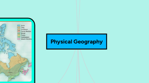
1. Geographic Regions
1.1. Western Cordillera
1.1.1. High jagged mountain peaks
1.1.2. Mountain goats
1.1.3. Forestation
1.2. Interior Planes
1.2.1. Flat, step-like landscape
1.2.2. Sedementary rock
1.2.3. Wheat
1.2.4. Farming
1.3. Hudson Bay Arctic Lowlands
1.3.1. Frozen Permafrost
1.3.2. Swamps
1.3.3. Flatland
1.3.4. Fishing
1.4. Innuition Mountains
1.4.1. High mountains
1.4.2. Rocky
1.5. Canadian Shield
1.5.1. Cottages
1.5.2. Lakes
1.5.3. Rocky, ruggy landscape
1.6. Appalachian Mountains
1.6.1. Tree covered mountains
1.6.2. Smooth valleys
1.6.3. Coal
1.7. St. Lawrence Great Lakes Lowlands
1.7.1. Rich soil
1.7.2. Rolling hills
1.7.3. Tourism
1.8. Rock Cycle
1.8.1. Magma
1.8.2. Metamorphic rock
1.8.3. Igneous rock
1.8.4. Sediments
1.8.5. Sedimentary rock
1.8.6. Geological Processes
1.8.6.1. Sedimentation
1.8.6.2. Earth's rotation
1.8.6.3. Weathering
1.8.6.4. Erosion
1.8.6.5. Earth's revolution
1.8.6.6. Pangea
2. Geological Eras
2.1. Glaciation
2.1.1. Ice age
2.1.1.1. Ended 15,000 years ago
2.1.1.2. Much of North America lay under a huge glacier
2.1.1.3. Mammoths, saber tooth cats, and lions
2.1.2. Moraines
2.1.2.1. Oak Ridges Moraine
2.2. Cenozioc
2.2.1. Ice sheets cover most of North America
2.2.2. Modern forms of life evolve
2.3. Mesozoic
2.3.1. Age of reptiles such as dinosaurs
2.3.2. Formation of Rocky Mountains begins
2.4. Paleozoic
2.4.1. Age of amphibians and fish
2.4.2. Large parts of North America is covered by shallow seas
2.5. Precambrian
2.5.1. First multi-celled organisms
2.5.2. Mountain building and erosion
2.6. Creation/Big Bang
2.6.1. Universe
2.6.2. Galaxies
2.6.2.1. Milky Way
2.6.3. Earth
2.6.4. Secular timeline of history
3. Plate Tectonics
3.1. Volcanoes
3.1.1. Eruption
3.1.1.1. Pompeii
3.1.1.2. Mount St. Helen
3.1.1.3. Ring of Fire
3.1.2. Lava flow
3.1.2.1. Main vent
3.1.2.2. Side vent
3.1.3. Volcanic ash
3.2. Convergent plate boundry
3.2.1. Mountain building
3.2.2. Two plates collide
3.2.3. Subduction
3.2.4. Rfit Valley
3.3. Divergent plate boundry
3.3.1. Two plates move apart
3.3.2. Mid Ocean Rdige
3.4. Transform plate boundry
3.4.1. Two plates slide past each other
3.4.2. Earthquakes
3.5. Earth's Layers
3.5.1. Crust
3.5.1.1. Oceanic crust
3.5.1.2. Continental crust
3.5.2. Inner and outer core
3.5.3. Mantle
3.5.4. Asthenosphere
3.5.5. Lithosphere
3.6. Natural Diasters/Hazards
3.6.1. Floods
3.6.2. Droughts
3.6.3. Tornadoes
3.6.4. Lightning
3.6.5. Earthquakes
3.6.6. Tsunamis
3.6.7. Cyclones
3.6.8. Landslides
4. National Parks
4.1. Banff National Park
4.2. Jasper National Park
4.3. Yoho National Park
4.4. Algonquin National Park
4.5. Waterton Lakes National Park
4.6. Cape Breton National Park
4.7. Point Pelee National Park
4.8. Riding Mountain National Park
4.9. Pukaskwa National Park
5. Climate Regions
5.1. Natural Vegetation Regions
5.1.1. Deciduous Forest
5.1.1.1. Most fertile soils of Eastern Canada
5.1.1.2. Deciduous trees
5.1.2. Mixed Forest
5.1.2.1. Coniferous and deciduous trees
5.1.2.2. Good lumbering industry
5.1.2.3. Humus in soil
5.1.3. Boreal and Taiga Forest
5.1.3.1. Coniferous trees
5.1.3.2. Infertile soil
5.1.4. Grasslands
5.1.4.1. Very dry
5.1.4.2. Dead grass on surface, but roots remain alive
5.1.5. Cordillera and West Coast Vegetation
5.1.5.1. Heavy rainfall
5.1.5.2. A lot of humus
5.1.5.3. Douglas Fir, spurce,
5.1.6. Tundra
5.1.6.1. Permafrost
5.1.6.2. Cold and dry climate
5.1.6.3. Small shrubs
5.2. Arctic
5.2.1. Harsh climate
5.2.2. Beside Arctic Ocean
5.3. Taiga
5.3.1. Long, severe winters
5.3.2. Convectional precipitation
5.4. Cordilleran
5.4.1. Varied climate
5.4.2. Near mountains
5.5. Pacific Maritime
5.5.1. Beside Pacific Ocean
5.5.2. High relief precipitation along the coast
5.6. Boreal
5.6.1. Cold winters
5.6.2. Warm summers
5.6.3. Convectional precipitation
5.7. Prairie
5.7.1. Very cold winters
5.7.2. Very hot summers
5.7.3. Dry
5.8. South-Eastern
5.8.1. Prevailing winds
5.8.2. Mostly continental climate
5.9. Atlantic Maritime
5.9.1. Cool
5.9.2. Humid
5.9.3. Beside Atlantic Ocean
5.10. Climate Systems (LOWERN)
5.10.1. Latitude
5.10.2. Ocean Currents
5.10.3. Wind and Air Masses
5.10.4. Elevation
5.10.5. Relief Precipitation
5.10.6. Near Water
5.11. Precipitation
5.11.1. Relief precipitation
5.11.2. Cyclonic precipitation
5.11.3. Convectional precipitation
6. Weather
6.1. Rainy
6.2. Sunny
6.3. Windy
6.4. Cold
6.5. Hot
6.6. Cloudy
6.6.1. Clouds
6.6.1.1. Cirrus
6.6.1.2. Cirrostratus
6.6.1.3. Cirrocumulus
6.6.1.4. Altrostratus
6.6.1.5. Altocumulus
6.6.1.6. Stratocumulus
6.6.1.7. Stratus
6.6.1.8. Cumulus
6.6.1.9. Cumulonimbus
6.6.1.10. Nimbostratus
6.7. Climate Graphs
6.7.1. Displays data
6.7.1.1. Bar graph
6.7.1.2. Line graph
7. Longitude and Latitude
7.1. Longitude
7.1.1. East or west of the meridian
7.1.2. Prime Meridian
7.1.3. Connects North and South Pole
7.2. Latitude
7.2.1. Parallel to the equator
7.2.2. Parallels
7.2.3. North or south of equator
7.3. Time Zones
7.3.1. Mountain time zone
7.3.2. Eastern time zone
7.3.3. Central time zone
7.3.4. Atlantic time zone
7.3.5. Newfoundland time zone
7.3.6. Pacific time zone

