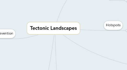
1. Characteristics of Earthquakes
1.1. Focus
1.1.1. The point below the Earth's surface. The depth below the surface varies with different Earthquakes. The point where pressure build up is released and causes shock waves to move out.
1.2. Epicenter
1.2.1. This happens on the Earth's surface. This is the place that is effected the worst. Plus buildings and infrastructure will be damages badly as well.
2. Prediction/ Prevention
2.1. Volcanoes
2.1.1. Education and Planning
2.1.1.1. People near Volcanoes were taught to look for signs for a Volcanoes activity
2.1.1.2. Example: Sicily, locals taught to watch for changes in the consistency of lava
2.1.2. Building design and Defense
2.1.2.1. Lava flow can be slowed down with water until it stops
2.1.2.2. Diversion channels can be built around the village
2.1.2.3. Example: On Mount Etna, earth walls have been built to divert lava flow - keeps it away from cable cars that are drove by thousands of tourists
2.1.3. Prediction
2.1.3.1. Example: Tiltmeters placed on the slopes of Mount St Helens predicted eruption
2.1.3.2. Example: The gases are often monitored. Mount Pinatubo was predicted due to the change in gas
2.1.3.3. Satellites can record a change in the volcanoes shape
2.2. Earthquakes
2.2.1. Education and Planning
2.2.1.1. Example: In Japan, schools and businesses practice Earthquake drills (ducking under tables)
2.2.1.2. Example: In the USA, the government provides information packs to prepare for Earthquakes
2.2.2. Building design and Defense
2.2.2.1. Automatic stutters (protect windows) and interlocking framework help buildings to be more Earthquake proof
2.2.2.2. Example: San Francisco airport has columns (1,5 m ball bearing) allowing the building to move with the Earthquake
2.2.3. Prediction
2.2.3.1. Seismometers predict the likelihood of an Earthquake to occur
3. Hotspots
3.1. These are points in the mantle where volcanoes occur. These fixed points in the mantle that generate heat. The build up in pressure and intense heat cause magma to break through the crust. The volcano forms as magma is pushed through the ocean surface. These hotspot's create chains, E.g. Hawaii.
4. Characteristics of plate boundaries
4.1. Convergent Plates
4.2. Divergent Plates
4.3. Conservative Plates
5. Scales
5.1. Richter
5.1.1. Uses a seismograph to measure Earthquake's magnitude. Scale is 1-9 with 10 points between each number. The scale is objective. The measurements can be done from a different location from the Earthquake site.
5.2. Mercalli
5.2.1. This measures the intensity of the Earthquake from an eyewitnesses account. Has a scale of 1-12 and is subjective (also uses whole numbers) People need to be present for them to measure the Earthquake.
6. Management
6.1. Volcanoes
6.1.1. Economical
6.1.1.1. Fertile soil
6.1.1.2. Cheap geothermal energy produced
6.1.1.3. Example: Coffee is grown in Colombia on volcanic slopes + Iceland has cheap electricity due to geothermal energy
6.1.2. Environmental
6.1.2.1. Area looks nice, increasing tourism
6.1.2.2. Example: Mount Etna provides jobs for locals
6.1.3. Social
6.1.3.1. Perceived risk is small
6.1.3.2. Near their family and friends
6.1.3.3. Moving is hard as there's poverty in LICs
6.1.3.4. Example: Mount St Helens in USA erupted - people didn't leave as they believed it wouldn't + Mount Edna (Sicily) erupted where many families on the slope lived + people lived in Mount Merapi in Indonesia
6.2. Earthquakes
6.2.1. Environmental
6.2.1.1. The wealthy want to stay in developed Earthquake areas
6.2.1.2. Example: Malibu, expensive coastal resort that has developed onto the coast of California (USA)
6.2.2. Social
6.2.2.1. Perceived risk is small (LICs)
6.2.2.2. Government has taken precaution (HICs)
6.2.2.3. Example: In Japan, buildings are Earthquake proof meaning locals are safe
6.2.3. Economical
6.2.3.1. Locals get jobs in tourist industry
6.2.3.2. Earthquake areas are scenic
6.2.3.3. Mining industry supplies many jobs for locals
6.2.3.4. Example: Iceland provides jobs for locals in the tourist industry + Chile, copper is mined. In 2007, 2 people died in a mining accident - acceptable as they have jobs
