
1. Maintenance Protocol Creation (Nate - 420)
1.1. Staff Training (Nate - 240)
1.1.1. Creating a training plan (Nate - 60)
1.1.2. Training staff on the data and applications (Nate - 180)
1.2. Maintenance Protocol Creation (Kyle - 180)
1.2.1. Developing a Maintenance Plan (Katie -150)
1.2.2. Implementing the Maintenance Protocol (Kyle -30)
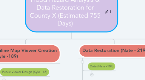
2. Online Map Viewer Creation (Kyle -189)
2.1. Public Viewer Design (Kyle - 45)
2.1.1. Developing a design scheme (Kyle - 30)
2.1.2. Verifying software requirements (Kyle - 15)
2.2. Public Viewer Construction (Katie - 127)
2.2.1. Building an Online Map Viewer (Katie - 120)
2.2.2. Adding the map viewer to the public portal (Katie - 7 )
2.3. Public Viewer Implementation (Kyle - 17)
2.3.1. Uploading data into the Map Viewer (Kyle - 7)
2.3.2. Updating cartographic design of the Map Viewer (Kyle - 10)
3. Data Restoration (Nate - 219)
3.1. Data (Nate -104)
3.1.1. Acquire the Data (Nate- 7)
3.1.2. Purchase the Data (Nate - 7)
3.1.3. Organize the Data (Nate -90)
3.2. Data Structure (Kyle - 64)
3.2.1. Create Improved Data Structure (Kyle - 30)
3.2.2. Populate the Geodatabase (Kyle - 20)
3.2.3. Optimize the Gedatabase (Kyle - 14)
3.3. System Evaluation (Katie - 51)
3.3.1. Evaluate Existing Hardware (Katie - 21)
3.3.2. Evaluate Existing Software (Kyle - 10)
3.3.3. Evaluate Existing Data Structure (Kyle - 10)
3.3.4. Evaluate Existing Applications (Kyle-10)
4. Flood Map Creation (Katie - 182)
4.1. Data Analysis (Kyle - 121)
4.1.1. Analyze the Data (Kyle- 90)
4.1.2. Digitize the Data (Kyle - 31)
4.2. Map Creation (Katie -61)
4.2.1. Generate Flood Hazard Boundary Maps (Katie - 31)
4.2.2. Generate Watershed Analysis Maps (Kyle - 10)
4.2.3. Generate Digital Elevation Models (DEM) (Katie -10)
4.2.4. Generate Flow Direction Maps (Nate - 10)