
1. FIELD NOTE
1.1. central business district is a concentration of business and commerce in the city's downtown
1.2. synekism is the conditions that derive from dwelling together in a particular home place or space
2. WHEN AND WHY DID PEOPLE START LIVING IN CITIES?
2.1. worldwide, more people live in urban areas than in rural areas today
2.2. urban refers to the built up space of the central city and suburbs
2.3. an urban place is distinctively nonrural and nonagricultural
2.4. for the vast majority of human history,t he world was largely rural
2.5. after the start of the Industrial Revolution in the mid-1700s in Great Britain, urbanization exploded "when some states such as Great Britain and the Netherlands became predominantly urban for the first time"
2.6. cities are centers of political power and industrial might, higher education and technological innovation, artistic achievement, and medical advances
2.7. a city is an agglomeration of people and buildings clustered together to serve as a center of politics, culture, and economics
2.8. The Hearths of Urbanization
2.8.1. an urban place is distinctively nonrural and nonagricultural
2.8.2. agricultural villages were relatively small in size and in population
2.8.3. everyone living in an agricultural village was involved in agriculture, and the people live at near-subsistence levels
2.8.4. egalitarian nature is the sharing of goods in common among the people
2.8.5. two components enabled cities to stabilize and grow:
2.8.5.1. agricultural surplus
2.8.5.2. social stratification
2.8.6. one theory maintains that advances in technology such as irrigation generated an agricultural surplus
2.8.7. another theory holds that a king or a priest-king centralized political power and then demanded more labor
2.8.8. the leadership class, or urban elite, consisted of a group of decision makers and organizers who controlled the resources, and often the lives, others
2.8.9. the urban elite controlled the food supply, including its production, storage, and distribution
2.8.10. the innovation of the city is called the first urban revolution
2.8.11. the six urban hearths are tied closely to the hearths of agriculture
2.8.11.1. the first hearth of agriculture, the Fertile Crescent
2.8.11.1.1. this urban hearth his called Mesopotamia
2.8.11.1.2. dated back to about 3500 BCE
2.8.11.1.3. found signs of social inequality in the varying sizes and ornamentation of houses
2.8.11.1.4. also established a priest-king class
2.8.11.2. the second hearth of urbanization is the Nile River Valley
2.8.11.2.1. dating back to 3200 BCE
2.8.11.2.2. the interrelationship between urbanization and irrigation in this region distinguishes it form other urban hearths
2.8.11.2.3. great pyramids, toms, and sphinx
2.8.11.3. the third urban hearth, is the Indus River Valley
2.8.11.3.1. dating back to 220 BCE
2.8.11.3.2. the intricate planning of the cities points to the existence of a leadership class, but the houses continued to be equal in size, with no places or monuments
2.8.11.4. the fourth urban hearth arose around the confluence of the Huang He (Yellow) and Wei (Yangtzi) Vally's
2.8.11.4.1. dating back to 1500 BCE
2.8.11.4.2. temples and palaces for the leadership class
2.8.11.5. the fifth urban hearth is Mesoamerica
2.8.11.5.1. dating to 1100 BCE
2.8.11.5.2. the ancient cities of Mesoamerica were religious centers
2.8.11.5.3. stone momuments
2.8.11.6. the sixth urban hearth is Peru
2.8.11.6.1. the Chavin built cities
2.8.11.6.2. dating back to 900 BCE
2.9. The Role of the Ancient City in Society
2.9.1. cities were the chief market places and bases from which wealthy merchants. land and livestock ownersl and traders operated
2.9.2. ancient cities were the anchors of culture and society
2.10. Diffusion of Urbanization
2.10.1. urbanization diffused from Mesopotamia in several directions
2.10.2. people migrated out from the hearth, diffusing their knowledge of agriculture and urbanization
2.11. Greek Cities
2.11.1. Greece is not an urban hearth because agriculture and urbanization diffused to Greece from Mesopotamia, rather than being independently innovated in Greece
2.11.2. second hearth of urbanization
2.11.3. by 500 BCE, Greece had become one of the most highly urbanized areas on Earth
2.11.4. acropolis (acro = high point, polis = city)
2.11.5. agora - market
2.11.5.1. became the focus of commercial activity
2.11.6. Greece's cities also had excellent theaters
2.11.7. housing was no better than it had been in the Mesopotamian cities thousands of years earlier
2.11.8. sanitation and health conditions were poor
2.11.9. urbanization diffused from Greece to the Roman Empire
2.11.10. Roman urbanization and urban culture diffused through western Europe
2.12. Roman Cities
2.12.1. the site of a city is its absolute location, often chosen for its advantages in trade or defense, or as a center for religious practice
2.12.2. the situation of a city is based on its role in the larger, surrounding context
2.12.3. the situation of a city is its relative location
2.12.4. the situation of a city changes with the times
2.12.5. Rome was the center of the Roman Empire, but when the Roman Empire dissolved, the situation of Rome changed, as well
2.12.6. it developed into the center fo the Roman Catholic Church
2.12.7. urban morphology is the layout of the city, its physical form and structure
2.12.8. functional zonation is how different areas or segments of a city serve different purposes or functions within a city
2.12.9. Forum served as the focal point of Roman public life
2.12.10. the Forum includes the world's first great stadium, the Colosseum
2.12.11. the city of the Roman Empire, like the city of today, was home to both rich and poor
2.13. Urban Growth after Greece and Rome
2.13.1. after the Roman Empire fell in 495 CE, Europe entered an era historians called the Middle Ages, which spanned from about 500-1300
2.13.2. urbanization continued vigorously outside of Europe
2.14. Site and Situation during European Exploration
2.14.1. before European exploration, most cities in the world were sited on trade routes
2.14.2. European maritime exploration and overseas colonization ushered in an era of oceanic worldwide trade
2.14.3. the trade networks European powers commanded (including the slave trade) brought unprecedented riches to Europe
2.15. The Second Urban Revolution
2.15.1. as thousands migrated to the cities with industrialization
2.16. A Second Agricultural Revolution
2.16.1. before the second urban revolution could take place, a second revolution in agriculture was necessary
2.16.2. the primary determinant in the location of early industrial cities was proximity to a power source
2.17. The Chaotic Industrial City
2.17.1. the diffusion of the railroad gave cities that were not near coal fields the chance to industrialize
2.17.2. living conditions were dreadful
2.17.3. health conditions were worse
2.17.4. water contaminated
2.17.5. during the second half of the twentieth century, the nature of manufacturing changed, as did its location: cities repositioned many factories away from congested, over crowded, expensive urban areas. companies simply abandoned large manufacturing plants
3. WHERE ARE CITIES LOCATED AND WHY?
3.1. site and situation help explain why certain cities were planned and why cities thrive or fail
3.2. across the multitude of quantitative studies in urban geography \m three components arose freuquently: population, trade area, and distance
3.3. Rank and Size in the Urban Matrix
3.3.1. rank-size-rule holds that in a model urban hierarchy, the population of a city or town will be inversely proportional to its rank in the hierarchy
3.3.2. thus, if the largest city has 12 million people, the second largest will have about 6 million (that is, half the population of the largest city)
3.3.3. the third city will have 4 million (one-third); the fourth city 3 million
3.3.4. the rank size rule does not apply in all countries, especially countries with one dominant city
3.3.5. primate city is a country's leading city
3.3.5.1. examples of primate cities in former colonies include:
3.3.5.1.1. Mexico City
3.3.5.1.2. Mexico and Manila
3.3.5.1.3. the Philippines
3.3.5.1.4. London and Paris
3.3.5.1.5. United Kingdom and France
3.4. Central Place Theory
3.4.1. central place theory - Walter Christellar attempted to develop a model to predict how and where central places in the urban hierarchy would be functionally and spatially distributed
3.4.2. first, the surface of the ideal region would be flat and have no physical barriers
3.4.3. second, soil fertility would be the same everywhere
3.4.4. third, population and purchasing power would be evenly distributed
3.4.5. next, the region would have a uniform transportation network to permit direct travel from each settlement to the other
3.4.6. finally, from any given place, a good or service could be sold in all directions out to a certain distance
3.5. Hexagonal Hinterlands
3.5.1. Christaller chose perfectly fitted hexagonal regions as the shape of each trade area
3.6. Central Places Today
3.6.1. Sun Belt phenomenon - the movement of millions of Americans from northern and northeastern States to the South and Southwest
3.6.2. Atlanta, Dallas, and Phoenix became headquarters cities for large regions, moving up in the urban hierarchy
4. HOW ARE CITIES ORGANIZED, AND HOW DO THEY FUNCTION?
4.1. city models reveal how cities are purposefully structured to perform the roles they have as centers of commerce, education, transportation, industry, and governance
4.2. Models of the City
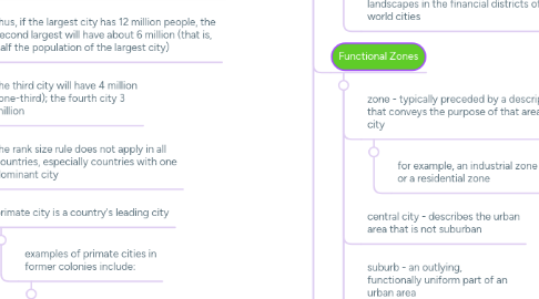
4.2.1. functional zonation - the division of the city into certain regions (zones) for certain purposes (functions)
4.2.2. globalization has created common cultural landscapes in the financial districts of many world cities
4.3. Functional Zones
4.3.1. zone - typically preceded by a descriptor that conveys the purpose of that area of the city
4.3.1.1. for example, an industrial zone or a residential zone
4.3.2. central city - describes the urban area that is not suburban
4.3.3. suburb - an outlying, functionally uniform part of an urban area
4.3.3.1. most suburbs are residential
4.3.4. suburbanization is the process by which lands that were previously outside of the urban environment become urbanized
4.3.5. 2000 census, which indicated that no less than 50 percent of he entire American population resided in the suburbs
4.3.6. of the population living in metropolitan areas, 62.2 percent resided in the suburbs, which in 2000 had 141 million residents
4.4. Modeling the North American City
4.5. Modeling the Cities of the Global Periphery and Semiperiphery
4.5.1. "colonial" cities as urban areas where European transplants dominated the form of the city, laying it out with Western styles
4.5.2. "indigenous" cities that remained remote from globalizing influences and carious forms of the Western city
4.5.3. primate cities in developing countries are called megacities when the city has a large population, a vast territorial extent, rapid in-migration, and a strained, inadequate infrastructure
4.5.3.1. for example, Mumbai, India, has more people than the country of Australia.
4.6. The South American City
4.6.1. 1980, Ernst Griffin and Larry Ford studied South American cities and derived a model of the South American city referred to as the Griffin-Ford model
4.6.2. South American cities blend traditional elements of South American culture with the forces of globalization
4.6.3. shantytowns are unplanned developments of crude dwellings and shelters made mostly of scrap wood, iron, and pieces of cardboard that develop around cities
4.6.4. disaamenity sector - the very poorest parts of cities that in extreme cases are not connected to regular city services and are controlled by gangs and drug lords
4.7. The African City
4.7.1. Africa now has the world's fastest growing cities
4.8. The Southeast Asian City
4.8.1. 1967, T.G. McGee studied the medium-sized cities of Southeast Asia
4.8.2. created a model referred to as the McGee model
4.8.3. the focal point of the city is the old colonial port zone combined withe the largely commercial district that surrounds it
5. HOW DO PEOPLE SHAPE CITIES?
5.1. government planning agencies can directly affect the layout of cities by restricting the kinds of development allowed in certain regions or zones of cities
5.2. zoning laws cities define areas of the city and designate the kinds of development allowed in each zone
5.2.1. example: Portland, Oregon
5.3. people shape cities by choosing to live in certain neighbor hoods and by opening stores, houses of worship, and even sporting fields that reflect the values of their culture
5.4. Shaping Cities in the Global Periphery and Semiperphery
5.4.1. people continue to migrate to cities in response to "pull" factors that are often more imaginary than real; their expectations of a better life
5.4.2. cities in poorer parts of the world generally lack enforceable zoning laws
5.4.3. without zoning laws, cities in the periphery have mixed land use throughout the city
5.4.4. across the global periphery, the one trait all major cities display is the stark contrast between the wealthy and the poor
5.5. Shaping Cities in the Global Core
5.5.1. blockbusting - realtors would solicit white residents of the neighborhood to sell their homes under the guise that the neighborhood was going downhill because a black person or family had moved in
5.5.2. white flight - movement of whites from the city and adjacent neighborhoods to the outlying suburbs
5.5.3. commercialization - transforming the central business district into an area attractive to residents and tourists alike
5.5.4. gentrification - the rehabilitation of houses in older neighborhoods
5.5.5. the growing interest in central-city housing has resulted in part from the changing character of American society:
5.5.5.1. the proportion of childless couples is growing, as is the number of single people in the population
5.5.6. rising housing costs associated with gentrification have played a key role in the growing problem of homelessness in American cities
5.5.7. the homes intended for suburban demolition are teardowns
5.5.8. new mansions that are supersize and have a similar look are called McMansions
5.6. Urban Sprawl and New Urbanism
5.6.1. urban sprawl unrestricted growth of housing, commercial developments, and roads over large expanses of land, with little concern for urban planning
5.6.2. sprawl is a phenomenon of the automobile era
5.6.3. urban sprawl is more rampant in the Sun Belt of the South (Atlanta) and in the West (Houston)
5.6.4. new urbanism - development, urban revitalization, and suburban reforms that create walkable neighborhoods with a diversity of housing and jobs
5.7. Gated Communities
5.7.1. gated communities are fenced in neighborhoods with controlled access gates for people and automobiles
5.7.2. as the main objective of a gated community is to create a space of safety within the uncertain urban world
5.7.3. many fear that the gated communities are a new form of segregation
5.7.4. the gated communities in China are 5 to 10 times more densely populated than gated communities in Europe and North America
5.8. Ethnic Neighborhoods in the European City
5.8.1. ethnic neighborhoods in European cities are typically affiliated with migrants from former colonies
5.8.1.1. for example: Algeria was a colon y of France, and now Paris and other French cities have distinct Algerian neighborhoods
5.8.2. governments in Europe are typically much more involved in the social rights of people
5.8.3. European cities are also much older than American cities
5.8.4. European cities are typically more compact, densely populated, and walkable than American cities
5.9. Government Policy and Immigrant Accomodation
5.9.1. whether a public housing zone is divided into ethnic neighborhoods in a European city depends in large part on government policy
5.10. Ethnic Neighborhoods in the Global Periphery and Semiperiphery City
5.10.1. in cities of the periphery and semiperiphery, a sea of sluslumsmd development typically begins where the permanent buildings end
5.10.2. fundamental problems - crowding, unemployment, unsanitary conditions, hunger, and a lack of education
5.11. Power and Ethnicity
5.11.1. extended families share and stretch every dollar they manage to earn
5.12. The Informal Economy
5.12.1. informal economy 0 the economy that is not taxed and is not counted toward a country's gross national income
5.13. From Colonial to Global CBD
5.13.1. the city now has a global CBD at the heart of the original colonial city, housing mostly foreign corporations and multinational companies and linked mainly to the global economy