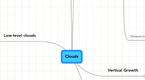
1. Mid-level clouds
1.1. Altostratus
1.1.1. Description:Altostratus clouds are composed of ice crystals, they are potentially dangerous because they can cause ice forming on an aircraft. They are grey or blue-grey. Altostratus clouds usually cover the entire sky. These clouds form announcing storms with continuous rain and snow. Through the thinnerlayers, the sun is visible vaguely as a round disk.
1.1.2. Pictures:
1.1.3. How do they form?:Altostratus clouds are caused by a large air mass that is lifted then condensed.
1.1.4. Weather Map Symbol:
1.1.5. Height:Between 2,000-5,000m
1.2. Altocumulus
1.2.1. Description:Altocumulus clouds are made of water droplets. They look like gray puffy masses sticking together in sheets and patches. When seen in the morning of a warm humid day, they signal thunderstorms later in the afternoon.
1.2.2. Pictures:
1.2.3. Weather Map Symbol:
1.2.4. Height:Between 2,400-6,000m
2. Low-level clouds
2.1. Stratus
2.1.1. Height:Up to 2,000m
2.1.2. Description:Stratus clouds are uniform, gray, and cover the entire sky. They look like fog that doesn’t reach the ground. These clouds create a light mist or drizzle sometimes.
2.1.3. Picture:
2.1.4. How do they form?:The stratus cloud is a cloud formed into a horizontal layer with a uniform base.
2.2. Stratocumulus
2.2.1. Height:Between 1,000-6,500m
2.2.2. Description:Stratocumulus clouds seem low with a grey puffy appearance. They usually form in rows with the blue sky visible in between them. These clouds are not followed by rain, however if they turn into nimbostratus clouds rain is usually occurs.
2.2.3. Picture:
2.2.4. Wheather Map symbol:
2.2.5. How do they form?:They are formed by water droplets. The clouds are formed by weak convection currents triggered by turbulent airflows. The dry, stable air above the cloud prevents the cloud’s movement upwards.
2.3. Nimbostratus
2.3.1. Height:Up to 2,400m
2.3.2. Picture:
2.3.3. Description:Nimbostratus clouds form a dark, grey, wet looking layer on the sky. It announces continuously falling of rain or snow in light to moderate quantities.
2.3.4. How do they form?:Nimbostratus clouds are typically found along a warm front producing low intensity precipitation that lasts for several hours.
3. Special Clouds
4. High-Level clouds
4.1. Cirrus
4.1.1. Description:Cirrus clouds are made of ice crystals. They have a thin appearance, blown in high winds into long streamers. Cirrus clouds are usually white and they predict fair to pleasant weather. Movement of these clouds indicates the direction from which weather is approaching. It usually indicates change in weather within 24 hours.
4.1.2. How do they form?:Cirrus clouds are formed when water vapor freezes into ice crystals at altitudes above 6,000 meters.Due to the low moisture levels at that high altitude, they appear to be very thin.
4.1.3. Picture:
4.1.4. Weather map symbol:
4.1.5. Height:6,000+m
4.2. Cirrostratus
4.2.1. Description:Cirrostratus clouds are made of ice crystals. They are thin, generally uniform clouds covering the entire sky. Formation of Cirrostratus clouds indicates the approach of rain or snow within 12-24 hours.
4.2.2. Height:6,000m
4.2.3. Weather Map Symbol:
4.2.4. Picture:
4.2.5. How do they form?:Cirrostratus clouds are formed when water vaporizes into ice crystals above 6,000m.
4.3. Cirrocumulus
4.3.1. Picture:
4.3.2. Weather Map Symbol:
4.3.3. Description:Cirrocumulus clouds are made of ice crystals and super-cooled water droplets. They are small white puffs arranged in long rows. Cirrocumulus clouds are usually seen in the winter announcing fair but cold weather. If they are encountered in tropical regions they might indicate an approaching hurricane.
4.3.4. Height:
4.3.5. How do they form?:
5. Vertical Growth
5.1. Cumulus
5.1.1. Height:Below 2,000m
5.1.2. Description:Cumulus clouds are white and puffy. They have a vertical appearance with a flat base and a rounded top. When the clouds look like a cauliflower head, they are called cumulus congestus. Cumulus clouds can grow into cumulonimbus clouds which may produce heavy rain, lighting, strong winds.
5.1.3. Picture:
5.1.4. Weather Map Symbol:
5.2. Cumulonimbus
5.2.1. Height:Below 2,000m
5.2.2. Description:Cumulonimbus clouds are tall, dense, usually involved in thunderstorm and other intense weather. The high winds can flatten the top of the cloud anvil-like shape. They are associated with heavy rain, snow, hail, lighting and even tornadoes.
5.2.3. How do they form?:
5.2.4. Picture:
5.2.5. Weather Map Symbol:
