
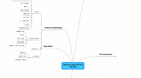
1. Organization
1.1. Current
1.1.1. Director
1.1.1.1. Senior Tax Mapper
1.1.1.2. Tax Mapper
1.1.1.3. Addressing Coordinater
1.2. Future
1.2.1. Director
1.2.1.1. Data
1.2.1.1.1. GIS Analyst
1.2.1.1.2. GIS Technician
1.2.1.1.3. GIS Technician
1.2.1.2. Development
1.2.1.2.1. GIS Developer
1.2.1.2.2. Database Administrator
2. Major Projects
2.1. Park Mapping
2.1.1. GPS Mapping
2.1.1.1. Parks
2.1.1.1.1. Primary
2.1.1.1.2. Secondary
2.1.1.2. Features
2.1.1.2.1. Trails
2.1.1.2.2. Shelters
2.1.1.2.3. Obstacles
2.1.1.2.4. Bridges
2.1.1.2.5. Elevation profiles
2.1.1.2.6. Location of signage
2.2. Ordinance Revision
2.2.1. Development Review
2.2.1.1. Parcel Creation
2.2.1.1.1. County staff records plat/deed
2.2.1.1.2. parcel split/combine
2.2.1.2. Digital Submission
2.2.1.2.1. CAD Template
2.2.1.2.2. GIS Template
2.2.1.2.3. Metadata
2.2.2. Addressing
2.2.2.1. Revise ordinance
2.2.2.1.1. Addressing authority
2.2.2.1.2. Reference addressing SOP
2.3. Park Connectivity
3. Notes from Whiteboard
3.1. Projects
3.1.1. Condo table
3.1.2. Consolidated data collection (GPS)
3.1.3. Sattelite Imagery
3.1.4. Slope Map
3.1.5. Network dataset
3.1.6. Web viewer
3.1.7. Land Cover
3.1.8. Change detection
3.1.9. contours
3.1.10. Internal Web viewers
3.2. Data Development
3.2.1. Marshall's Data
3.2.2. SO Data
3.2.3. Fire Incidents
3.2.4. Sex Offenders
3.2.5. Capital Improvement Program
3.3. DB Replication
3.4. GPS inventory
3.4.1. Trailer Parks
3.4.2. Industrial Parks
3.4.3. Apartment Complexes
4. GIS Development
4.1. Process Change
4.1.1. Parcel Creation Process
4.1.1.1. Centralize parcel creation process
4.1.1.2. County records plat as part of the development review process
4.1.1.3. Splits/combines handled through one dept
4.1.1.3.1. may require GIS tech in assesors
4.1.2. Addressing
4.1.2.1. Web submission of address changes/clarification
4.1.2.1.1. Trusted parntners
4.1.2.1.2. General public
4.2. Public Involvement
4.2.1. Website
4.2.1.1. Add to I want to?
4.2.1.1.1. Make a map?
4.2.1.1.2. Fix a problem with my address?
4.2.1.2. Publish Standards
4.2.1.2.1. Address
4.2.2. Seminars
4.2.2.1. Public
4.2.2.2. Internal
4.3. Standards
4.3.1. Quality Control
4.3.1.1. SQL Queries
4.3.1.2. Create Condo Table
4.3.1.3. Create standards for all maps
4.4. Data Development
4.4.1. Network Development
4.4.1.1. create geometric network
4.4.1.2. add speed limits to segments
4.4.2. Topography
4.4.2.1. Hillshade
4.4.2.2. Contours
4.4.2.3. Slope Model
4.4.3. Planimetrics
4.4.3.1. centerline adjustment
4.4.3.2. building footprints
4.4.3.3. extend centerlines one mile outside of county
4.4.4. Addressing
4.4.4.1. refine address ranges
4.4.5. Environmental
4.4.5.1. groundwater recharge areas
4.4.5.2. riparian areas
4.4.6. Planning and Zoning
4.4.6.1. update zoning feature class
4.4.6.1.1. incorporate overlay into zoning
4.4.6.2. create future development feature class
4.4.6.2.1. consolidate character areas, nodes, and corridors into one feature class
4.4.7. Attribute Cleanup
4.4.7.1. Delete unused attributes
4.4.7.2. Aliases
4.4.8. Relational Data
4.4.8.1. add permits to parcels (assessors)
4.5. Viewer Development
4.5.1. Web Development
4.5.1.1. ArcServer
4.5.1.1.1. Data Services
4.5.1.1.2. Web Portals
4.5.1.2. Tax Map Library
4.5.2. Application Development
4.5.2.1. Create address application
4.5.2.2. create crime map
4.6. Infrastructure
4.6.1. DB replication
4.6.2. Dedicated DBs
5. Stakeholders
5.1. Engineering
5.1.1. Geoff Morton
5.2. Development Services Center
5.2.1. Ana Silbernagel
5.3. Planning & Zoning
5.3.1. Jeff Watkins
5.4. E9-1-1
5.4.1. Chris Collett
5.5. Parks and Rec
5.5.1. Keith Hammond
5.5.1.1. Mapping parks
5.5.1.1.1. Blankets Creek
5.5.1.1.2. Garland Mtn
5.6. County Manager
5.6.1. Capital Improvement Program
5.6.1.1. view recent photo
5.6.1.2. timelines/schedules
5.6.1.3. budget
5.6.2. Jerry Cooper
5.7. Sherriff's Office
5.7.1. Roger Garrison
5.8. Fire Marshall
5.8.1. Rick Ruh
5.9. Fire Department
5.9.1. Phil Sheffer
5.9.1.1. map every paved road and access street that a fire truck can go down
5.9.1.2. fire hydrant maintenance plan
5.9.1.3. Batalion chiefs access to data
5.9.1.3.1. incident data
5.9.1.3.2. fire marshall data
5.9.1.3.3. incident location populated on map
5.9.1.3.4. occupancy info
5.9.1.4. AVL added to all aparatus
5.9.1.5. getting data from field workers to eoc is secondary to getting data from eoc to field workers
5.9.1.6. bn chief should be able to put a marker on map and say road is closed and info goes out to concerned parties
5.9.1.7. fire rms is accessible through map
5.10. Capital Improvement Program Manager
5.10.1. Chuck Abbott
5.11. Facilities
5.11.1. Matt Williams
5.12. IT
5.12.1. Evariste Nya
5.13. Roads & Bridges
5.13.1. Cliff Harden
5.13.1.1. did not meet
5.14. Rural Transportation Program
5.14.1. Elaine Makowsky
5.15. Voter Registration
5.15.1. Janet Munda
5.15.1.1. address verification
5.15.1.1.1. geocode voter rolls and check against geography
5.15.1.1.2. need web portal to check addresses against voting districts
5.15.1.1.3. new set of voter maps
5.15.1.1.4. would like web site to show voter wait times at polling locations
5.15.1.2. would like to have projects completed by july 2010
5.16. Tax Commisioner
5.16.1. David Fields
5.17. Marshall's Office
5.17.1. Ray Waters
5.17.1.1. marshall zones
5.17.1.1.1. need map to show zones
5.17.1.1.2. need a list of streets in each zone
5.17.1.2. maps
5.17.1.2.1. map citations
5.17.1.2.2. analyze citations
5.17.1.2.3. animal attacks to a person