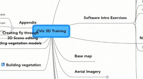
1. Building vegetation
1.1. Preparation
1.1.1. Detailed vegetation digitizing
1.1.2. Points
1.1.2.1. Hawth's tools
1.1.2.2. CViz Build Out
1.1.3. Existing Land Cover eg NLCD
1.1.4. Textured Vegetation
1.1.5. Parking Lot example
2. Building vegetation models
3. 3D Scene editing
4. Creating fly through
5. Appendix
5.1. Landscape models
5.2. TimeScope
5.3. Build Out
6. Software Intro Exercises
6.1. ArcMap
6.2. MultiGen Paradigm SiteBuilder
6.3. MultiGen Paradigm Modelbuilder
6.4. 3D Analyst
6.5. Spatial Analyst
6.6. ArcGIS Explorer
6.7. ArcGIS Server
6.8. Google Earth Pro
6.9. SketchUp
6.9.1. Basics of SketchUp (Pages 3-18, step 30)
6.9.2. Intersect and Follow Me (Read only, Pages 77-79)
6.9.3. Working with Roofs (P117-120, step 5)
6.9.4. Painting and Textures (Basic P175-200)
6.9.5. Wrapping images for scene backdrops (P212-218)
6.9.6. Google Earth and SketchUp (P281-295) - Robin please also compare to similar exercise in CViz tutorial for overlap)
6.9.7. Painting and Textures (Advanced P53-78, step 10 and P84-100)
6.9.8. Sandbox tools (Advanced P175-187)
6.10. Graphics Program (Photoshop or Graphic Workshop Pro)
7. Building linear features
8. Software overview
8.1. Software
8.1.1. ArcMap
8.1.2. MultiGen Paradigm SiteBuilder
8.1.3. MultiGen Paradigm Modelbuilder
8.1.4. 3D Analyst
8.1.5. Spatial Analyst
8.1.6. ArcGIS Explorer
8.1.7. ArcGIS Server
8.1.8. Google Earth Pro
8.1.9. SketchUp
8.1.10. Graphics Program (Photoshop or Graphic Workshop Pro)
8.2. Functions Index
8.2.1. Base map
8.2.1.1. ArcMap
8.2.1.2. Spatial Analyst
8.2.1.3. ArcGIS Server
8.2.2. Model building
8.2.2.1. SketchUp
8.2.2.2. MultiGen Paradigm Modelbuilder
8.2.3. Fly throughs
8.2.3.1. MultiGen Paradigm SiteBuilder
8.2.3.2. 3D Analyst
8.2.3.2.1. ArcScene
8.2.3.2.2. ArcGlobe
8.2.3.3. ArcGIS Explorer
8.2.3.4. Google Earth Pro
8.2.4. Landscape models
8.2.4.1. SketchUp
8.2.4.2. Spatial Analyst
8.2.5. Aerial Imagery
8.2.6. Working with Photos
8.2.6.1. SketchUp
8.2.6.2. Graphics Program (Photoshop or Graphic Workshop Pro)
9. Base map
10. Aerial Imagery
10.1. Sitebuilder
10.1.1. Image vs screen grab
10.2. 3D Analyst
10.2.1. Resolution? one example
10.3. Readable Image types
10.4. Importing images into Google
10.5. Replacing images with polygons
11. Working with Photos
11.1. Photo angles
11.2. pattern replication vs whole
11.3. Alpha channels
11.4. Coarse fine image vs horizon billboard
11.5. Trees _
11.5.1. See through leaves/ branches
11.5.2. photo Vs paintings
11.5.3. life cycle
11.5.4. tree Shadow B&W
11.5.5. Random points-heights/Types
