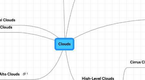
1. Stratus Clouds
1.1. -The height of these clouds are up to 6,500 feet
1.2. -Stratus Clouds are uniform grayish clouds that often cover the entire sky
1.3. -Formed when very weak, upward vertical air current thin layer of air high enough to start the water vapor
2. Alto Clouds
2.1. -The height of these clouds can be between 6,500 feet-18,000 feet
2.2. -Alto Clouds are usually white and predict fair to pleasant weather.
2.3. Composed of ice and are thin, wispy clouds blown in high winds into long streamers
3. Low-Level Clouds
3.1. New node
4. Low-Level Clouds
4.1. Nimbostratus Clouds
4.1.1. - These clouds can be 2000m up high
4.1.2. - These clouds are dark gray with a ragged base.
4.1.3. - Nimbostratus clouds are associated with continuous rain or snow. Sometimes they cover the whole sky and you can't see the edges of the cloud.
4.2. Stratocumulus Clouds
4.2.1. - These clouds are formed when warm, moist air is mixed with dry, cooler air and the mixture is moving beneath warmer, lighter air above.
4.2.2. - These clouds can be 1,000-7,000 ft up high
4.2.3. - These clouds can indicate if a bad weather is coming or a bad weather is clearing
5. Vertical Growth Clouds
5.1. -A group of clouds that has more then one appeance
5.2. -The height of these clouds are 12,000 meter
5.3. - There is no certian way that this group of clouds can form due to the fact they are all different.
6. High-Level Clouds
6.1. Cirrus Clouds
6.1.1. - Thin enough for the sun and moon can be seen through them
6.1.2. - Form in winter and summer depending on speed and strengths of weather front
6.1.3. - These clouds are above 18,000 feet
6.2. Cirrostratus Clouds
6.2.1. -Cirrostratus are sheet-like, high-level clouds composed of ice crystals. Cirrostratus clouds can cover the entire sky and be up to several thousand feet thick, they are also transparent enough for the sun and the moon to be seen through them.
6.2.2. - Cirrostratus clouds thicken as a warm front approaches, signifying an increased production of ice crystals.
7. Mid-Level Clouds
7.1. Altocumulus Clouds
7.1.1. - Altocumulus may appear as parallel bands or rounded masses.
7.1.2. - Altocumulus clouds usually form by convection in an unstable layer aloft, which may soon become a cold front.
7.2. Altostratus Clouds
7.2.1. These clouds can be up 2000-7000m up high.
7.2.2. An altostratus cloud usually covers the whole sky and has a gray or blue-gray appearance.
7.2.3. If rain will fall from an Altostratus cloud. If the rain hits the ground, then the cloud becomes classified as a Nimbostratus cloud.
7.3. Altostratus Clouds
7.3.1. - These clouds can be 2000-7000m up high.
7.3.2. - An Altostratus cloud usually covers the whole sky and has a gray or blue-gray appearance.
7.3.3. -If rain will fall from an Altostratus cloud. If the rain hits the ground, then the cloud becomes classified as a Nimbostratus cloud.
