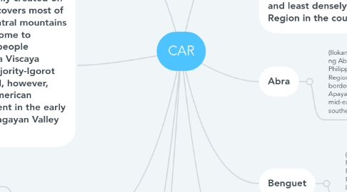
CAR
Adiecel Endozoにより

1. The region comprises eight provinces: Abra, Apayao, Benguet, Ifugao,Kalinga and Mountain Province. The regional center is the highly urbanized city of Baguio.
2. The region, officially created on July 15, 1987,[2] covers most of the Cordillera Central mountains of Luzon, and is home to numerous ethnic people collectively. Nueva Viscaya province has a majority-Igorot population as well, however, was put by the American colonial government in the early 20th century in Cagayan Valley region instead.
3. Apayao
3.1. (Ilokano: Probinsia ti Apayao) is a landlocked province in the Philippines in the Cordillera Administrative Region in Luzon. Its capital town is Kabugao.
3.2. The province borders Cagayan to the north and east, Abra and Ilocos Norte to the west, and Kalinga to the south. Prior to 1995, Kalinga and Apayao comprised a single province named Kalinga-Apayao, which was partitioned to better service the needs of individual ethnic groups.
3.3. With a population of 119,184 (as of the 2015 census)[2] covering an area of 4,413.35 square kilometres (1,704.00 sq mi),[1] Apayao is the least densely-populated province in the Philippines.
4. Ifugao
4.1. (Ilokano: Probinsia ti Ifugao; Filipino: Lalawigan ng Ifugao) is a landlocked province of the Philippines in the Cordillera Administrative Region in Luzon. Its capital is Lagawe and it borders Benguet to the west, Mountain Province to the north, Isabela to the east, and Nueva Vizcaya to the south.
4.2. The Rice Terraces of the Philippine Cordilleras and Banaue Rice Terraces are the main tourist attractions in the province. These terraces are believed to have been hand-carved into the mountains 2,000 years ago to plant rice. However, recent research by carbon dating suggests that they were built much later.[3] In 1995, they were declared as a UNESCO World Heritage Site.
5. Mountain Province
5.1. (Filipino: Lalawigang Bulubundukin), is a landlocked province of the Philippines in the Cordillera Administrative Region in Luzon. Its capital is Bontoc.
5.2. Mountain Province was formerly referred to as Mountain in some foreign references. The name is usually shortened by locals to Mt. Province. The province was named so for being in the Cordillera Central mountain range found in the upper realms of Luzon island.
5.3. Mountain Province was also the name of the historical province that included most of the current Cordillera provinces. This old province was established by the Philippine Commission in 1908,[3][4][5] and was later split in 1966 into Mountain Province, Benguet, Kalinga-Apayao and Ifugao.[6][7][8]
5.4. The province is also known for its mummy caves, which contain naturally mummified bodies, and for its hanging coffins.[6]
6. Cordillera Administrative Region (Ilokano: Rehion/Deppaar Administratibo ti Kordiliera; Filipino: Rehiyong Pampangasiwaan ng Cordillera), designated as CAR, is an administrative region in the Philippines situated within the island of Luzon. The only landlocked region in the country, it is bordered by the Ilocos Region in the west and southwest, and by the Cagayan Valley on the north, east, and southeast. Prior to the 2015 census, it is the least populated and least densely-populated Region in the country.
7. Abra
7.1. (Ilokano: Probinsia ti Abra; Filipino: Lalawigan ng Abra) is a landlocked province of the Philippines in the Cordillera Administrative Region in Luzon. Its capital is Bangued, and is bordered by Ilocos Norte on the northwest, Apayao on the northeast, Kalinga on the mid-east, Mountain Province on the southeast, and Ilocos Sur on the southwest.
8. Benguet
8.1. (Tagalog pronunciation: [beŋˈɡet]; Ibaloi: Probinsya ne Benguet; Ilokano: Probinsia ti Benguet; Pangasinan: Luyag na Benguet; Filipino: Lalawigan ng Benguet), is a landlocked province of the Philippines located in the southern tip of the Cordillera Administrative Region in the island of Luzon. Its capital is La Trinidad.
9. Kalinga
9.1. (Ilokano: Probinsia ti Kalinga; Filipino: Lalawigan ng Kalinga) is a landlocked province in the Philippines situated within the Cordillera Administrative Region in Luzon.
9.2. Its capital is Tabuk and borders Mountain Province to the south, Abra to the west, Isabela to the east, Cagayan to the northeast, and Apayao to the north.
9.3. Kalinga and Apayao are the result of the 1995 partitioning of the former province of Kalinga-Apayao; which was seen to better service the respective needs of the various indigenous peoples in the area.


