
1. Water,ice and wind creates the eroded sediment that forms soil. Most soils have different levels from top to bottom. A soil profile is marked by straight bands of color, which becomes a lighter brown with a increasing depth. The darker and thicker the upper layer of soil, the greater soil fertility. In polar and continental climates has a thick layer of permanently frozen ground called permafrost. Plants roots cant grow that deep into the ground. The natural vegetation in this area is mostly low shrubs and summer flowers
1.1. Permafrost
1.2. Soils
1.2.1. The effect of climate on soil
1.2.1.1. Climate is the main factor that creates soil. A good climate is favorable for plants and animals to flourish. Water, ice and wind create the eroded sediments for soil. Heavily rainfall and tumbling streams wear down rock faces. Climate causes the force of erosion that produce soil.
2. This type of farming is in most developing nations. Farming that produces a large surplus of crops, livestock or any type of farming products and they sell it for a profit. The commercial farmers don't use their own grown food, they go to the local supermarket. Some of these farmers families are big agribusiness owners( commercial agriculture) business = head of big companies
2.1. Organic Foods
2.1.1. Foods produced with products that make it grow faster with chemicals and others. Some commercial farmers specialize in organic foods, Many customers are willing to pay the extra price for organic foods
3. Landforms
3.1. Plains and Low Lands Region
3.1.1. Rivers and glaciers carried eroded material which is cause sediment. They increased into thick beds that slowly created sediment rock. New land formed which are plains and low lands and there under layers of sediment rock.
3.1.1.1. Under these lowlands are layers of sedimentary rock
3.2. Active Volcanoes
3.2.1. The ring of fire is a ring of active volcanoes surrounding the Pacific ocean. Active volcanoes are volcanoes that have a possiblity of eruption so it has magma underneath it.
3.2.1.1. Active Volcanoes with a possibility of eruption with magma underneath it
3.2.1.2. A large volcano made up of layers of lava
3.2.1.2.1. Composite Cone
3.2.1.3. Shield Cone
3.2.1.3.1. A volcano made entirely of magma.
3.3. Shield Regions
3.3.1. Pangea braking apart
3.3.2. Canadian shield region made from Pangea breaking apart
3.3.2.1. Pangea was built around old shield regions which were made up of igneous rocks( solidified magma) later heat and pressure formed metamorphic rocks and Pangea broke apart and the shield regions were scattered all across the world and some of the shield regions are: Canadian shield and etc.
3.4. Fold Mountains
3.4.1. Two plates going up and down
3.4.2. Mountain layers of rocks begin to bend
3.4.2.1. Fold mountain forming after a couple of million years
3.4.3. A fold mountain is made when two plates go up and down, when the two plates go up and down rocks cannot bend which means the mountains plates/rocks bend and turn into a fold mountain a couple of million of years later. Fold mountains are made up of one rock, sedimentary rocks which are rocks made up of layers. Popular Fold Mountains are found in the Himalayas in Asia and the Andes in South America. Fold mountains are found where tectonic plates meet, A large chain that runs the entire length of North America of South America continuing to Antarctica. There is another that goes from Europe to Asia east and west.
3.4.3.1. Fold Mountains separate the flow of streams and the elevation of a fold mountain creates unique ecosystem for a certain type of plants/ animals.
3.5. Interesting Facts about Fold Mountains
3.6. Rivers
3.6.1. Water is the most common part of erosion. Water erosion is most obvious in valleys that have rivers carved into the landscape; These valleys are among the most heavily populated regions for a reason. Valleys often have fertile soils because rivers carry lots of sediment down to the ocean.
3.6.2. River systems
3.6.2.1. The whole network of streams and lakes that form one river.
3.6.2.2. Worlds longest river systems
3.6.3. Drainage Patterns
3.6.3.1. Dendritic and trellis patterns are the results of landforms and underlying rocks
3.6.3.1.1. Denedritic Patterns
3.6.3.2. Trellis Patterns
3.6.3.2.1. The rectangular drainage pattern created if rivers flow through alternating bands of hard and soft rocks.
4. Agriculture(growing crops and raising animals)
4.1. Different types of Agriculture
4.1.1. Shifting Cultivation
4.1.1.1. A type of farming performed by indigenous(native to the country) farmers in the rainforest. They use fire and sharp machetes to clear small parts of jungle and work on them, they call this the slash( machetes) and burn(fire). Sweet potatoes and cassava(a starchy root) are raised, as well as corn.
4.1.2. Intensive Farming
4.1.2.1. In South Asia, Most agriculture there is Intensive Farming. Intensive Farming is where agriculture with much labour is used to get food from small plots of land.
4.1.3. Extensive Farming
4.1.3.1. Agriculture in which little labour is used but big machinery is used to get food from big farms. Most Agriculture in North America is Extensive Farming, wheat, corn and beef cattle are produced this way.
4.1.4. Subsistence Agriculture
4.1.4.1. Farms that produce only for the farm family, they work full time as a food provider for their family mainly their own labour. This often occurs where their is great pouplation density eg( China, India), Also mountains, rainforests and desert regions.
4.1.5. Nomadic Herders
4.1.5.1. Herds of goats, camels or cattle are the rewards of the Nomadic Herders in Africa, Central Asia and the Middle East. These are semi-desert regions and livestock supplies the nomadic herders needs. Camels and goats provide African and Middle Eastern herders with milk, meat, hides and hair for (tent and clothing). Live animals can be used for coffee and other uses. Nomadic Herders survive on their ability to find patches of grass and small watering holes to support their animals.
4.1.6. Small Landholders
4.1.6.1. Many people in Mexico, South America, Africa and South Asia have small,permanent farms. They get corn, rice, vegetables and other grains with some animals sometimes. Everyone in the family works hard in the farm and if there's a small surplus of land it gets traded at the local market. Small landholders live to the end of poverty and the weather helps them in their life if its good then they'll continue on if its bad their life will turn bad.
4.1.7. Commercial Agriculture
4.1.7.1. Location and Climate
4.1.7.1.1. Location and climate are a huge factor of affecting commercial agriculture. Soil, climate and natural vegetation are different from place to place. Best place for commercial agriculture is where the local temperature is good for the crops and livestock
4.1.7.1.2. Commercial crops such as tender fruits(peaches, plums, pears and cherries) cannot survive in bad climate. Fruit orchards are only found in locations protected by cold winds and heavy freezing
4.1.7.2. Farming that produces a large surplus of a few types of crops, livestock and other farm products. It then sells the farm products they made for a large profit. Some of the commercial farms are owned by their families which are sometimes heads of big companies that own the commercial farm. Commercial farmers buy their groceries at a local supermarket.
4.1.7.3. Raw Materials
4.1.7.3.1. Commercial agriculture requires a bit of raw food called farm inputs. Most poultry farms don't raise their birds from eggs, Instead they buy a large amount of small chicks from specialty breeders. They are kept under warming lights and are fed grains to grow. Other farmers buy calves and fatten them and sell them for meat. Crop farmers use different raw materials. They buy seeds that scientists create and treat them with farm chemicals and some of them control the growth of weeds and insects that harm food crops.
4.1.7.4. Labor and Machinery
4.1.7.4.1. The balance of hard work and machinery differs largely from a commercial farm to an other. This is the opposite of extensive agriculture, which relies on machinery to do it. Vegetable farms have a different mix of labor and machinery compared to a large prairie wheat farm.
4.1.7.5. Transportation
4.1.7.5.1. Grains such as wheat and corn are the major food crops outside of South Asia, Canadian Wheat farms in Alberta, Saskatchewan and Manitoba are usually large family owned operations. Most of the work is done using tractors, plows, combine- harvesters, and other machinery. The wheat is sent to railroad points. Long trains of special self dumping railway grain cars take it to port terminals. Without this networks of roads, railroads, and ships, wheat could not get to Canada or foreign markets.
4.1.7.6. Market Forces
4.1.7.6.1. A customer plays a important role for success or failure for a commercial farmer. Beef competes with pork, poultry, lamb, fish and other protein sources. Consumer tastes determine how much the steak will be sold compared to fish. Examples: If their is not enough steak for BBQ season then prices will rise. If there's too much, prices will fall to attract customers. Producer marketing boards sponsor advertising and web sites to promote beef, milk, cheese, and other farm products
4.1.7.7. Coffee: Location and Labour
4.1.7.7.1. Coffee is produced in the tropical climates of Central and South America, Africa and South Asia. The trees need plenty of sunlight, without too much heat. They grow best in well-drained soils, on hillsides 1000-2500 meters above sea level, where it is cooler. Each tree produces enough beans for 0.7kg of roasted coffee. Both small landholdings and large plantations grow coffee trees. A great deal of hand labour is required to pick and dry the product before it is mechanically sorted and roasted.
4.1.8. Specialized Agriculture
4.1.8.1. Commercial farming that focuses on one type of product. There are many specialized farms that do not create food. Tobacco, Cotton and flower farms are a example. The following crops show how both physical and humans affect specialized agriculture.
4.1.9. Orange Groves(trees): Climate and Market
4.1.9.1. Florida ranks second in the world as largest orange grower. Orange trees and fruits are easily damaged by freezing temperatures. Due to the cold, Florida's tree's have steadily shifted southward, where there is less risk. There are many different types of oranges, each with a different growth rate. This allows growers to offer fresh fruit year round. Today about 80% of Florida's crops are squeezed into orange juice. The oranges producers' association has created a demand for orange juice through a half century of advertising campaigns.
4.1.10. Nurseries: Location and Raw Materials
4.1.10.1. Nurseries supply trees, flowers and other plants to make places pretty. Most are found near big cities for customers. Locations must have lightly textured, well-drained soils suited to many types of plants. Greenhouse gases are often used to grow flowers and fancy grasses from seed in hot, moist- conditions. Nursery raw materials include seedlings(very young trees), fertilizers, peat moss and mulch( the last too prevent plants from dieing out)
4.1.11. Fair Trade
4.1.11.1. A pricing system that gives food in developing countries fairer prices for their products. Farmers are organized into cooperative groups, to fully process the products themselves. They sell it to Fair trade imports at a guaranteed price, often twice as much individual farmers will get. These buyers ship the products to developed countries as offer it as a special brand. For example: a cup of fair trade coffee costs an extra 10cents. More and more customers ask for fair trade products when they learn that it is fairer for growers in developing countries.
5. Intense rainfall occurs at the equator the air moves northward and southward and it reaches the tropics and sends it back to the equator as wind. Very dry weather condition's.Rain is very rare.
6. Natural Disasters
6.1. Tornadoes
6.1.1. Humid air rises and wind starts to rotate the column of cold air which then creates a vortex then it carries objects upwards. Tornadoes form on open land. Most tornadoes occur in Tornado Alley- In the US.
6.2. Hurricanes
6.2.1. As warm air rises cold air replaces it, cold air blows inward in a swirl creating a tropical disturbance and as the new air is heated and rises the tropical disturbance grows larger and spins faster which is how a hurricane forms, hurricanes affecting the Caribbean and East North America originate off the coast of Africa
6.2.1.1. Typhoons form from heat rising and the warm air pushing up into the sky causing a large swirling action of a typhoon and the heat of the air can keep it growing and growing, Typhoons originate in the Pacific Ocean
6.2.1.1.1. A cyclone is the same as a typhoon and Hurricane(forms the same) a cyclone forms when hot air rises and cold air replaces it, the cold air swirls up which causes a tropical disturbance and a cyclone is between a hundred km wide - 1000km wide. Typhoons form over the the Indian Ocean.
6.3. Earthquakes
6.3.1. An earthquake occurs when plates are ripped apart, pulled together and dragged together. Rocks getting pulled can bend a bit until it snaps and moves a few centimeters together and releases a lot of energy at the epicenter( the point where earth's plates move suddenly that cause a earthquake) An earthquake is measured with the Richter scale. Most earthquakes occur in: North America South America, ,Japan, Australia, Africa, Philippines, Carribean and Haiti.
6.4. Tsunamis
6.4.1. A tsunami occurs from underground earthquakes: occur from the boundaires of the earth's tectonic plates which cause the water to move up and down,
7. Climate
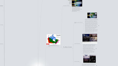
7.1. Climate= Weather condition's in a certain area. This is a weather condition map in Canada.
7.1.1. The effect of latitude
7.1.1.1. The sun is a important factor in affecting climate in the world. Hot places are near the equator and the cold places are Antarctica and places near the Arctic Ocean. Places at different latitudes get different climates, The sun is more intense towards the equator and less intese at other places.
7.1.2. The effect of climate
7.1.2.1. The effect of moving air and winds and pressure
7.1.2.1.1. The heat of sun is another import factor of climate. Your basement is cooler then the main floor, This is because warm air is light and rises and cool air is dense and sinks moving wind and pressure causes a repeating climate above and below the equator.for example: heated air rises just like home, when air rises it cools and water droplets form clouds. \Douala has intense cloudbursts and receives 4times more rain per year then other places. Different air pressures are found compared to the tropics. Light, raising air at the equator creates a region of low air. Farther north and south, descending air results in high pressure zones
7.1.2.2. The effect of water bodies
7.1.2.2.1. Bodies of water make temperature more comfortable and enjoyable. Places near large bodies of water have a maritime climate(warm summers and cool winters) Lots of precipitation occurs when wind blows onshore. Places located in far inland are not moderated by water bodies and they have Continental Climates = Hot summers and cold winters, This climate is drier then maritime climate.
7.1.2.3. The effect of mountains
7.1.2.3.1. Places at high latitudes are cooler then places at low latitudes. The back of a mountain is cooler then side of the mountain receiving radiation from the sun. Mountain climates near coastlines get a lot of rain.
7.1.2.4. The effect of Ocean currents
7.1.2.4.1. The winds of the planet help circulate the waters in oceans. Currents of warm water flow from the equator to coastlines, While cold currents flow to the equator from the polar. Warm and cold currents affect coastal temperatures, for example: One place is affected by the cold Labrador current of the Arctic Ocean. Another place is warm by the Gulf stream of the tropical Atlantic ocean.
7.2. Types of Climate-
7.2.1. Maritime climates
7.2.1.1. Warm summers and cool winters. Lots of precipitation when winds blow onshore
7.2.1.1.1. Maritime and Continental climates picture
7.2.2. Continental climates
7.2.2.1. Hot summers and cold winters, This type of climate is drier then Maritime Climate.
7.2.3. Desert climates
7.2.4. Mountain climates
7.2.4.1. Places at high latitudes are cooler then places at low latitudes. Mountain climates near coastlines get a lot of rain.
7.2.5. Polar climates
7.2.5.1. HARDCORE winters and cool summers.
7.2.6. Tropical climates
7.2.6.1. Hot temperatures in every season and lots of moisture. Sun rays strike earth directly overhead, Focused sun radiation year rounds = area's near the equator are hit with hot temperatures. ex: Singapore is near the equator so it experiences hot and wet tropical climates.
7.2.7. Temperate climates
7.2.7.1. Moderate temperature conditions year round, Perth, Australia is between the equator and south pole. It has a mid latitude location with moderate temperatures. The sun ray's hit earth's curved surface at an angle, enough to make sun energy less intense at Perth the Singapore.