

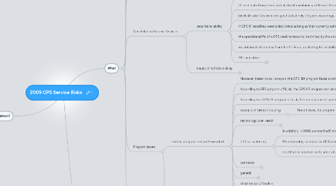
1. What is the map about?
1.1. A review of a risk assessment of the GPS Service from 2009
1.2. The information in this map was used in a blog post on this topic
1.3. Source
1.3.1. GAO announcement
1.3.1.1. April 30, 2009
1.3.2. GAP PDF report source
1.3.3. Documents
1.3.3.1. Summary of GAO report
1.3.3.1.1. What is it?
1.3.3.1.2. Dependency
1.3.3.1.3. Physical
1.3.3.1.4. the scenario
1.3.3.1.5. there is a DoD modernisation program
1.3.3.1.6. various programs not well-executed
1.3.3.1.7. service risk
1.3.3.1.8. under utilization or ground services
1.3.3.1.9. US leadership
1.3.3.1.10. lots of other stuff on working with civil and international groups
1.3.3.1.11. conclusions broadly supported by the DoD
1.3.3.2. Articles
1.3.3.2.1. Reg
1.3.3.2.2. Defense News
1.3.3.2.3. InsideGNSS
2. other responses
2.1. DoD Report Oct 2008
2.1.1. After all, the DoD’s biennial report to Congress about GPS, submitted last October had (once again) pointed out the condition of the constellation, “Of the 31 GPS satellites currently on orbit, 20 are past their design life, and 19 are without redundancy in either the navigation mission equipment or the satellite bus, or both.”
2.1.2. And DoD didn’t have to look as far ahead as GPS III for capability risk scenarios: “Should GPS IIF launches be delayed, sustainment of the GPS constellation will be difficult, and the [U.S. government] could fail to meet performance levels prescribed in published federal plans and standards.”
2.2. May 7 congressional hearing
2.2.1. statement
2.3. Col. Dave Buckman, a spokesman for Air Force Space Command
2.3.1. by May 21
2.3.2. did echo the GAO's concerns of a "potential risk associated with a degradation in GPS performance" but said "we have plans to mitigate risk and prevent a gap in coverage."
2.3.3. used twitter
3. What
3.1. GAO report
3.1.1. issued early April
3.1.2. congressional hearing
3.2. GPS overview
3.2.1. what is it
3.2.1.1. The GPS space segment consists of a constellation of satellites that move in six orbital planes approximately 20,200 kilometers above the earth.
3.2.2. what is does
3.2.2.1. GPS is a global positioning, navigation, and timing network consisting of space, ground control, and user equipment segments that support the broadcasts of military and civil GPS signals.
3.2.2.2. These signals each include positioning and timing information, which enables users with GPS receivers to determine their position, velocity, and time, 24 hours a day, in all weather, worldwide.
3.2.3. uses
3.2.3.1. military
3.2.3.1.1. GPS is used by all branches of the military to guide troops’ movements, integrated logistics support and battlespace situational awareness, and communications network synchronization.
3.2.3.1.2. In addition, bombs and missiles are guided to their targets by GPS signals and GPS is used to locate military personnel in distress. Early in the development of GPS, the scope was expanded to include complementary civil capabilities
3.2.3.2. other
3.3. Dependency
3.3.1. Over time, GPS has become a ubiquitous infrastructure underpinning major sections of the economy, including telecommunications, electrical power distribution, banking and finance, transportation, environmental and natural resources management, agriculture, and emergency services in addition to the array of military operations it services.
3.3.2. For instance, civil agencies, commercial firms, and individuals use GPS to accurately navigate from one point to another. Commercial firms use GPS to route their vehicles, as do maritime industries and mass transit systems. In addition to navigation, civil departments and agencies and commercial firms use GPS and GPS augmentations2 to provide high-accuracy, three-
3.3.3. GPS has a myriad of uses besides just helping drivers get from Point A to Point B with real-time personal navigation devices affixed to the dashboard of their cars.
3.3.4. Most smart phones come equipped with GPS, allowing a user to map his precise location at any moment, and it is widely used by the maritime and aviation industries, mass transit systems, communications networks and even electrical power grids.
3.3.5. Besides civilian applications, the U.S. military uses encrypted GPS signals for troop movements, logistics, communications and search and rescue.
3.4. Threat
3.4.1. However, DOD predicts that over the next several years many of the older satellites in the constellation will reach the end of their operational life faster than they will be replenished, thus decreasing the size of the constellation from its current level and potentially reducing the accuracy of the GPS service.
3.4.2. U.S. Reassures on Reliability of GPS Satellites
3.4.2.1. not a question of failure
3.4.2.2. Sensational reports
3.4.2.2.1. Reg
3.4.2.3. AF response
3.4.2.3.1. on Twitter
3.4.3. failure rate exceed refresh rate
3.4.4. like pop statistics, lead to extinction or ineffective service way before that
3.4.5. the report described scenarios — for instance a two-year setback in launching the first GPS III spacecraft — that could lead to deterioration in the quality of GPS service due to delays in building new generations of satellites and past program management problems.
3.4.5.1. note the use of scenarios
3.4.5.2. reduced capability
3.5. Impact
3.5.1. we have had it good
3.5.1.1. the GPS constellation has been operating above the committed performance standard for so long, military and civil users have come to expect a higher level of service, even though this service is not committed to them
3.5.1.2. longer life of satellites
3.5.2. 21 would be ok just less than we have expected
3.5.2.1. some users may see an impact if the constellation were to perform at or near its committed standards.
3.5.3. military targetting
3.5.3.1. The accuracy of precision-guided munitions that rely upon GPS to strike their targets could decrease. To accomplish their mission, military forces would either need to use larger munitions or use more munitions on the same target to achieve the same level of mission success.
3.5.3.2. The risks of collateral damage could also increase.
3.5.3.3. It also uses GPS to direct "smart" bombs and missiles and the GAO report warned that decreased performance could have an impact on military strikes. "The accuracy of precision-guided munitions that rely upon GPS to strike their targets could decrease," the GAO said. "The risks of collateral damage could also increase."
3.5.4. “The GPS constellation isn’t an on-or-off thing,” James told the subcommittee members, adding as an example, “We can adjust the constellation to put less accuracy over a less populated area.”
3.5.5. graceful failure and not so much a gap
3.5.5.1. “We’re using the term gap and that sounds pretty black and white, but the GPS constellation degrades more gracefully because of the number of satellites,”
3.6. Current State
3.6.1. In recent years, because numerous satellites have exceeded their design life, the constellation has grown to 31 active satellites of various generations.
3.7. Constellation Survival Analysis
3.7.1. + satellite reliability
3.7.1.1. the reliability curves associated with new blocks of GPS satellites are based solely on engineering and design analysis instead of actual on-orbit performance,
3.7.1.2. this estimated long-term probability of maintaining a 24-satellite constellation could change once actual on-orbit performance data become available.
3.7.1.3. block IIA satellites were designed to last only 7.5 years on average, they have actually lasted about twice as long.
3.7.1.4. If GPS IIF satellites were to last twice as long as their currently estimated mean life expectancy of 11.5 years, the probability of maintaining a larger constellation would increase, but the long-term probability of maintaining the 24-satellite constellation would not improve significantly
3.7.1.5. the operational life of a GPS satellite tends to be limited by the amount of power that its solar arrays can produce. This power level declines over time as the solar arrays degrade in the space environment until eventually they cannot produce enough power to maintain all of the satellite’s subsystems.
3.7.1.6. we obtained information from the Air Force predicting the reliability for 77 GPS satellites—each of the 31 current (on-orbit) and 46 future GPS satellites—as a function of time.
3.7.1.6.1. Each satellite’s total reliability curve defines the probability that the satellite will still be operational at a given time in the future.
3.7.1.6.2. It is generated from the product of two reliability curves—a wear-out reliability curve defined by the cumulative normal distribution, and a random reliability curve defined by the cumulative Weibull distribution.
3.7.1.6.3. sound like Google
3.7.1.7. MC simulation
3.7.1.7.1. Using the reliability curves for each of the 77 GPS satellites, we developed a Monte Carlo simulation2 to predict the probability that at least a given number of satellites would be operational as a function of time, based on the GPS launch schedule approved in March 2009.
3.7.1.7.2. We conducted several runs of our simulation—each run consisting of 10,000 trials—and generated “sawtoothed” curves depicting the probability that at least 21, 24, 27, and 30 satellites would still be operational as a function of time.
3.7.1.7.3. We confirmed that our simulation produces results that are within about 2 percent of the Aerospace Corporation’s results for all times between October 2008 and April 2024.
3.7.1.7.4. We then used our Monte Carlo simulation model to examine the impact of a 2-year delay in the launch of all GPS III satellites.
3.7.2. - impact of schedule delay
3.7.2.1. For example, a 2-year delay in the production and launch of the first and all subsequent GPS III satellites would reduce the probability of maintaining a 24-satellite constellation to about 10 percent by around fiscal year 2018
3.7.2.2. nice graph on page 22 showing the impact of a 2 year delay
3.8. Program issues
3.8.1. various programs not well-executed
3.8.1.1. However, based on our analysis, the GPS IIIA program faces a compressed schedule along with new challenges to deliver the satellites on time. A slip in the launch of the GPS IIIA satellites could increase the likelihood that the GPS constellation will fall below the number of satellites required to provide the level of GPS service the U.S. government has committed to provide.
3.8.1.2. According to GPS program officials, the GPS IIF program was also negatively impacted by multiple contractor mergers, acquisitions, and moves
3.8.1.3. According to a GPS IIF program official, the combination of significant requirements additions, loss of engineering expertise, parts obsolescence, and fundamental design changes together caused the contractor to “lose the recipe” for the IIF space vehicle.
3.8.1.4. example of failure in testing
3.8.1.4.1. Nonetheless, the program has experienced more technical problems. For example, last year, during the first phase of thermal vacuum testing (a critical test to determine space-worthiness that subjects the satellite to space-like operating conditions), one transmitter used to send the navigation message to the users failed.
3.8.1.5. technology over-reach
3.8.1.5.1. Generally, we have found that DOD starts its space programs too early, that is before it has assurance that the capabilities it is pursuing can be achieved within resources and time constraints.
3.8.1.5.2. action
3.8.1.6. diffuse leadership
3.8.1.6.1. In addition, in 2006 we testified8 that diffuse leadership over military space acquisitions was another factor contributing to late delivery of capability and cost growth.
3.8.1.6.2. More recently, a commission13 formed pursuant to the John Warner National Defense Authorization Act for Fiscal Year 200714, concluded in 2008 that there is currently no single authority responsible for national security space—which includes GPS—below the President
3.8.1.6.3. no effective mechanism to arrive at a unified budget and set priorities.
3.8.1.7. contracts
3.8.1.7.1. We have also tied acquisition problems in space to inadequate contracting strategies; contract and program management weaknesses; the loss of technical expertise; capability gaps in the industrial base; tensions between labs that develop technologies for the future and current acquisition programs; divergent needs in users of space systems; and other issues that have been well documented.
3.8.1.8. general
3.8.1.8.1. At times, cost growth has come close to or exceeded 100 percent, causing DOD to nearly double its investment without realizing better return on investment. Along with the increases, many program experiencing significant schedule delays—as much as 7 years—postponing delivery of promised capabilities to the warfighter.
3.8.1.9. short tenure of leaders
3.8.1.9.1. We also noted that short tenures for top leadership and program managers within the Air Force and the Office of the Secretary of Defense have lessened the sense of accountability for acquisition problems and further encouraged a view of short-term success.
3.8.1.10. result
3.8.1.10.1. As a result of these problems, the IIF program experienced cost increases and schedule delays. The launch of the first IIF satellite has been delayed until November 2009—almost 3 years late. According to the program office, the cost to complete GPS IIF will be about $1.6 billion—about $870 million over the original cost estimate of $729 million.
3.8.1.11. action
3.8.1.11.1. using an improved risk management process, where the government is an integral part of the process.
3.8.1.11.2. see page 15 - 16
3.8.2. delays in modernizing and deploying the constellation
3.9. Alternatives
3.9.1. Options for developing lower-cost alternatives to current GPS satellites appear to be very limited.
3.9.1.1. p24
3.9.2. According to Air Force representatives, the procurement of additional IIF satellites is not feasible, and initiating development of an alternative fullscale, satellite-based PNT system appears to be impractical.
3.9.3. Finally, it seems unlikely that the award of a separate system development contract with another contractor would have any real impact on reducing the risk of delivering GPS IIIA requirements on the current schedule.
3.9.4. all seem a bit self serving
3.9.5. better power management may increase lifetime
3.9.5.1. the effects of this power loss can be mitigated somewhat by actively managing satellite subsystems—shutting them down when not needed— thereby reducing the satellite’s overall consumption of power. It would also be possible to significantly reduce the satellite’s consumption of power by shutting off a secondary GPS payload.
3.9.6. plan for reduced service
3.9.6.1. While a smaller GPS constellation could result in a significant reduction in positioning and navigation accuracy at certain times and locations, these times and locations are usually predictable in near-real time.
3.9.7. use other satellite services
3.9.7.1. For civil and commercial users, one possible impact of a smaller GPS constellation could be an increased use of other positioning, navigation, and timing services, including those expected to be offered through Europe’s Galileo system by the middle of the next decade.
3.10. US leadership
3.10.1. there is an expressed desire for GPS to serve as the world’s preeminent positioning, navigation, and timing system. In addition, while the United States is challenged to deliver GPS on a tight schedule, other countries are designing and developing systems that provide the same or enhanced capabilities.
3.10.2. Ensuring that these capabilities can be leveraged without compromising national security or the preeminence of GPS is also a delicate balancing act that requires close cooperation between DOD, the Department of State, and other institutions.
3.10.3. other programs, notably from China and Russia
3.10.3.1. p47