

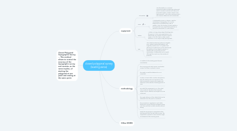
1. methodology
1.1. is installed at the starting point (known coordinates)
1.2. the mooring point with known coordinates is seen, the team is placed in zeros
1.3. the angle is read the distance to D1 is measured
1.4. location of each delta must be adequate to take the details and move forward in the field, proceed to measure the angles and distances to the details of starting points of view
1.5. we install the equipment in D1, the initial view is placed, we place the horizontal angle in zeros. distance and angle to D2 are measured
1.6. the angle distance of the details that can be observed from the point is measured
1.7. the procedure is repeated in each delta taking into account that the polygonal does not cross and that no delta remains without taking
1.8. finally the equipment is assembled at the starting point and the last delta is seen, the equipment is placed in zeros and the angle is measured at the mooring point
2. equipment
2.1. Theodolite
2.1.1. The theodolite is a universal mechanical-optical measuring instrument used to measure vertical and, above all, horizontal angles, a field in which it has high precision. With other auxiliary tools it can measure distances and unevenness.
2.2. Prism
2.2.1. A topographic prism is a device, used for measuring in topography, of a circular shape that is constituted by a set of crystals. Thus, the function of said crystals is to project the EMD signal that produces an electronic theodolite or a total station.
2.3. Stakes
2.3.1. A stake is a long, sharp object that digs into the ground. It has many applications, as a demarcator of a section of land, to anchor ropes in it to lift a tent or other similar structure, or as a way to help plant growth.
2.4. Gps
2.4.1. The Global Positioning System (in English, GPS; Global Positioning System), and originally Navstar GPS, is a system that allows you to determine on the whole Earth the position of any object (a person, a vehicle) with an accuracy of up to centimeters ( if differential GPS is used), although the usual are a few meters of precision.