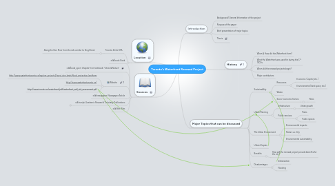
1. Sources
1.1. Book
1.2. Chapter from textbook: "Cities & Nature"
1.3. Website
1.3.1. http://www.waterfrontoronto.ca/explore_projects2/west_don_lands/flood_protection_landform
1.3.2. http://www.waterfrontoronto.ca/
1.3.3. http://www.toronto.ca/waterfront/pdf/waterfront_wdl_risk_assessment.pdf
1.4. Newspaper Article
1.5. Academic Research/ Scholarly Publications
1.5.1. http://www.trca.on.ca/dotAsset/25776.pdf
1.6. Film
2. Location
2.1. Toronto & the GTA
2.1.1. Along the Don River from the rail corridor to King Street
3. Introduction
3.1. Background/ General Information of the project
3.2. Purpose of the paper
3.3. Brief presentation of major topics
3.4. Thesis
4. History
4.1. When & How did the Waterfront form?
4.2. What the Waterfront was used for during the 17- 1900s
4.3. When did the renewal projects begin?
4.4. Major contributors
5. Major Topics that can be discussed
5.1. Sustainability
5.1.1. Resources
5.1.1.1. Economic (capital, etc.)
5.1.1.2. Environmental (land space, etc.)
5.1.2. Waste
5.1.3. Socio-economic factors
5.1.3.1. Risks
5.2. Urban Planning
5.2.1. Infastructure
5.2.1.1. Urban growth
5.2.2. Public services
5.2.2.1. Parks
5.2.2.2. Public spaces
5.3. The Urban Environment
5.3.1. Environmental impacts
5.3.2. Nature vs. City
5.3.3. Environmental sustainability
5.4. Urban Utopias
5.5. Benefits
5.5.1. How will the renewal project provide benefits for the city?
5.6. Disadvantages
5.6.1. Urbanization
5.6.2. Flooding
