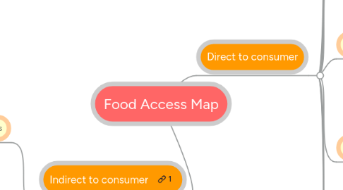
1. Indirect to consumer
1.1. Supermarkets/groceries
1.1.1. Business directory?
1.1.2. USDA ERS
1.1.3. Suppliers list
1.2. Corner stores
1.2.1. Healthy on the Block
1.2.1.1. BPHC
1.2.1.1.1. Anne McHugh
1.2.1.1.2. Javier Gutierrez
1.2.2. Healthy Corner Stores Initiative
2. Direct to consumer
2.1. CSAs
2.1.1. Local Harvest
2.1.2. Farmers' markets directors
2.1.3. subsidized CSAs
2.1.3.1. Farm to Family
2.1.4. Food For Free
2.2. Farmers' markets
2.2.1. Winter markets
2.2.2. City of Boston map
2.2.3. Mass Grown map
2.3. Urban farms
2.3.1. The Food Project
2.3.2. City Growers
2.3.3. ReVision House
2.3.4. Allandale Farms
2.3.5. Garden Girl?
2.3.6. BRA zoning maps
2.3.6.1. Where is it possible to farm?
2.4. Public markets
2.4.1. Don Wiest
2.5. Community gardens
2.5.1. BNAN
2.5.1.1. Valerie Burns
2.5.1.2. Boston Gardeners Council
2.5.2. individual gardens
2.5.2.1. Is there a directory?
2.5.2.2. Allston Community Farming
2.5.2.2.1. Phyllis Glass
2.6. Urban orchards
2.6.1. BNAN
2.6.2. Peter Boune
2.7. School gardens
2.7.1. Food Corps
2.7.2. BPS
2.7.2.1. Michael Peck
2.7.2.2. Kim Szeto
2.7.3. MA Farm to School Project
2.8. Food banks
2.8.1. GBFB
2.8.2. Faith-based
2.8.3. St. Francis House
2.8.4. Suppliers of food banks
2.8.4.1. Food For Free
2.8.4.1.1. list of locations
2.8.4.2. CANshare
2.8.4.3. Project Bread
2.8.4.3.1. Ellen Parker
2.8.4.4. Fair Food
2.8.4.5. Boston Gleaners
2.8.4.6. Gaining Ground
2.9. Hospitals
2.9.1. Prescription programs
2.9.2. Direct provision
2.10. Fishing
2.10.1. Publicly accessible?
2.10.2. Farmers' market intiatives
2.10.3. CSAs
