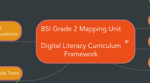
1. PURPOSE
2. Standards & Essential Questions
2.1. Media Literacy
2.1.1. Online Community: Who can we connect to in different parts of the world? How does digital technology affect that?
2.1.2. How do map makers use digital tools?
2.1.3. Is Google Earth a map? Who is the map maker? How is it alike/different from other maps?
2.2. Digital Skills
2.2.1. Keyword Search for Location
2.2.2. Uploading and inserting images
2.2.3. Typing locations and map info
2.2.4. Logging in to a Google Account
2.3. Social Studies
2.3.1. Understanding Map Functions
2.3.1.1. how maps work: different maps, finding self
2.3.2. Understanding how map makers work
2.3.2.1. maps reflect the POV of the mapmaker
2.3.2.2. birds-eye view
2.3.3. Why is NY location Special
2.3.3.1. strategic placement
2.3.3.1.1. waterways
2.3.3.1.2. proximity
2.3.3.1.3. explorers
2.3.3.2. trade
2.3.3.2.1. difficult across land
2.3.3.3. why map change over time
2.3.3.4. New Amsterdam to Brooklyn Bridge
2.3.4. Why maps? for communication
2.4. Common Core
3. Texts & Media Texts
3.1. trade books
3.2. atlases
3.3. NYC books
3.4. Other Google Maps
3.5. Using student-produced Google Maps in the Classroom
4. CONTENT
5. ASSESSMENT
6. Work Products
6.1. Baseline Map Making
6.1.1. analog map the classroom
6.1.2. labeling, color, scale, continents
6.1.3. draw map of the world (baseline)
6.1.4. map your relatives (google maps)
6.1.5. Customizing Content on maps in Google Earth
6.2. Imaginary World Maps (oct-nov)
6.2.1. Map Key
6.2.2. Color Coding
6.2.3. Images showing animal types etc.
6.3. Explorers Brochures
6.4. Post Office Locations
6.4.1. using Google Earth to show where messages can be sent
6.4.2. using email to send messages abroad
7. Tools (Tech)
7.1. Google Earth
7.2. Reach the World Geogames
7.3. Minecraft Extension Activity (study group)
8. Instructional Strategies
8.1. Classroom Learning Centers
8.1.1. Keys
8.1.2. Grids
8.1.3. Lat/Longitude
8.1.4. Color
8.1.5. Fonts
